Most Changes To Weaken Subdivision Ordinance Dropped At August 29 Meeting
After August 29th’s Town Council workshop meeting, there was some confusion about what was on the table. Councillor Stokes retracted many amendments to the subdivision ordinance, but a few remain and will be presented at the next workshop and be in the agenda packet for the next meeting on September 11. Other councilors may have more amendments.
On August 29, testimony was given by experts Jim Riordan of Weston and Sampson, a planner and water expert; Lorraine Joubert, a water expert at URI; Matt Dowling, the Town’s Wastewater Manager and Environmental Scientist; and Jane Weidman our professional and experienced Town Planner. They focused mainly on the important benefits of undisturbed land, and the reduction of impervious surfaces to benefit quantity and quality of groundwater. Also discussed was the relative ability of lots of various sizes to accommodate septics and wells. What was not always understood was that the larger area of undisturbed land offsets the potentially smaller lots and that in conservation design, lots are sited on the soils best suited to such development. One-half-acre lots are the minimum, not the mandated size. An acre or more is often the final size but this allows the flexibility to site lots in the best places and protect sensitive areas. The issue with the original cluster is that the developer and Planning Commission were locked into the underlying density, so a 40,000 square-foot lot (1 Acre) had to be no less than that, and that sometimes resulted in wetland buffers being included in a private lot where it is often filled in, or put to lawn or otherwise rendered useless for its proper function as a buffer to a wetland. The Planning Commission wanted the ability to rearrange or reduce the lot size enough to bring the buffer out of the lot. Many folks do not understand the need to protect these buffers. The State sets the rules as to what is considered a constraint to development and those have been reduced in recent years often by lobbying from builder associations, resulting in more lots and more impacted lots.
Many emails and conversations were noted by Councillor Stokes as to why he retracted the proposed changes that would have resulted in increases to the number of lots allowed in each subdivision, an increase in forest clearing, and an increase in impervious surface coverage.
Assertions by Council President Deb Carney that untrue statements abounded were not quite accurate. Although they were not what was actively proposed it would be the result of some of the proposals that density would increase and sensitive areas be included in lots or afford subdivision on otherwise unbuildable lots thereby increasing density. Ms Carney wanted to include additional lots for workforce housing in such subdivision; while a possible idea, there are many legal ramifications involved and it needs extensive further study to provide some of these in some form, and once again this would be an increase in the number of lots.
Protecting our groundwater i.e. our drinking water is vitally important and to do it with the best practices known at the moment while still maintaining the housing density currently allowed, since a developer has a right to develop a lot to that density. I would expect a Town Council to embrace those best practices.
Conservation subdivision development is one such best practice as embraced by many states and towns across the country. Low-impact development already in our ordinance and regulations is another. Choice is nice to have but not always appropriate and it is generally a professional developer who is given that choice unless town rules proscribe it otherwise. The town should be the one to direct growth and manage the ordinance and regulations for the benefit of the town, not the developer.
Options exist for residential compounds at half density with a private road, conventional subdivision in specific cases, and often for frontage lots, but that requires no open space offset and for cluster subdivision requiring an undisturbed open space set aside, (conservation design is a refinement of cluster that has been around for almost 40 years. ) There is also the option to conserve the land with an easement to protect it. Open space in these cases means undisturbed land to infiltrate and clean groundwater among other benefits. Impervious cover and land management practices by owners are the main contributors to pollution. Reducing those ie. roads, paved driveways, and activities that will make the ground impervious including some active recreation, lawn impaction, roof runoff, etc. helps to reduce the negative effects of development and all development has some negative impact.
Support by the community to not increase density, to protect groundwater in the best way possible, to maximize the undisturbed land, and to protect sensitive areas is needed. The Planning Commission needs that support to be able to provide regulations that developers must adhere to in order to protect our groundwater as much as we can. That is done through public hearings and ordinance adoption. Conservation development was adopted before the last election but landowners were riled up with a legal letter to oppose it and the current elected council has been trying to alter it ever since.
Thank you to those who came out to the meeting to support the current subdivision ordinance or to learn more. Please keep coming.

You can learn more about the author, Frances Topping, at her profile page.
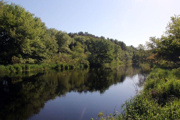
The banner image is a photo of the Pawcatuck River in Carolina. The pristine quality of the river is threatened by development in general, and especially by septic waste, and loss of forest cover throughout the watershed. How Charlestown develops will control the fate of the river.

September 9, 2023 @ 9:27 am
Well said Fran.
September 8, 2023 @ 2:15 pm
Thank you for providing some clarity on this most important resident subject.
We came to Charlestown 23 years ago after enjoying the joys of Charlestown for 25 summers of recreation. I am already amazed at the growth of properties in the last 20 years. We must protect our natural resources .
September 8, 2023 @ 12:58 pm
Yes thank you Frances for your knowledge, expertise, and ability to explain!
I agree with Michael. We MUST PROTECT OUR GROUNDWATER AND NATURAL RECOURCES!
There are good reasons for the EPA and environmental regulations, lets not reinvent the wheel.
September 1, 2023 @ 5:43 am
Thank you, Frances, for this report. Water, both groundwater and surface, should be a prime concern of areas that rely heavily on wells. The USGS has recorded that the levels in aquifers in RI have dropped in the last decade due to increase use and drought conditions during that time period. Nationally, this is a problem in some of the more agricultural areas due to center pivot irrigation and other irrigation pumping that we also have in Washington County. As the water is depleted, overlying layers of rock (in southern RI – fractured rock) can compact resulting in land subsidence. Impervious surfaces increase runoff and retard recharge of the aquifers. Rooftops, streets. other paved surfaces increase runoff. So the balance between development and conservation must be carefully researched and planned because once the water regime is adulterated or depleted, the cost to recover will be nearly impossible.