Developers Propose Major Expansion For Shoreline Plaza
When: Wednesday, June 22 at 7 p.m.
Where: Charlestown Town Hall
What: Master Plan Meeting for the redevelopment of the Shoreline Plaza on Old Post Road with addition of five new commercial buildings and Preliminary Plan presentation for a 4-lot residential frontage subdivision at the corner of Old Mill Road and Rt. 112 (Carolina Back Road).
Video Stream: You can view a live stream of the meeting via Webex on June 22 at 7 p.m when this application will be reviewed, but to participate with questions or comments you must be at Town Hall.
You can review all the materials submitted by the applicant and the agenda for the entire June 22 meeting at the Charlestown website. The meeting packet is only 58 pages long.
All meetings of the Planning Commission are public and the public is encouraged to attend and participate in this meeting.
“Shoreline Plaza“: Last parcel on Old Post Road next to South Kingstown line (9.12 acres)
Shoreline Plaza is located in the Charlestown Traditional Village District (TVD), the Historic Village District, and the Groundwater Protection Overlay District. It is also regulated by the CRMC Salt Pond Area Management Plan (SAMP). It is sited on a 9.12 acre lot at 3769 Old Post Road in Charlestown (Plat 13 Lot 30). At present there is a 9,444 square foot commercial building and a 37,153 square foot existing parking area. The remaining area of this commercial lot is currently undeveloped and wooded.
The proposed development consists of changes to the existing commercial building that has a floor area of 9,444 square feet, and construction of five new one-story commercial buildings, with a total of 25,393 square feet of building floor area, new parking areas, a new septic system (OWTS) and a new public well. The developer is proposing that one of the buildings would be a new pharmacy.
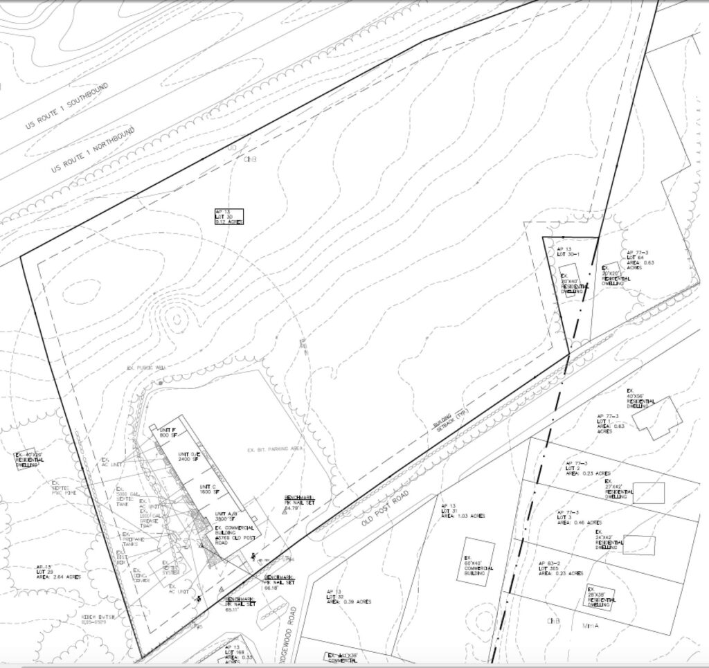
The first image below is a site drawing of the property as it is developed today (all development is in the southwest corner and the rest of the site is forested).

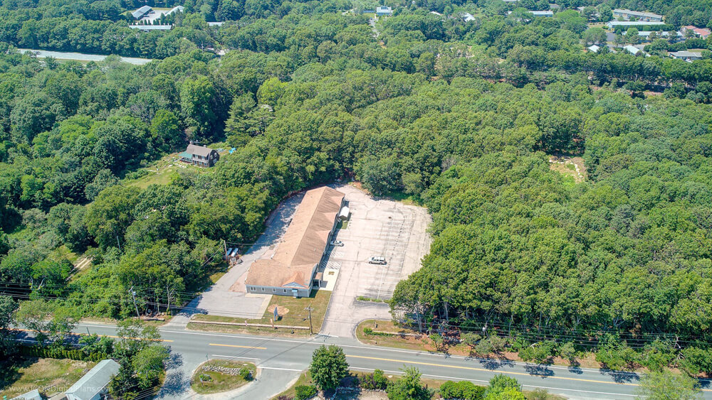
The image below is an aerial photo of the site as it exists today.

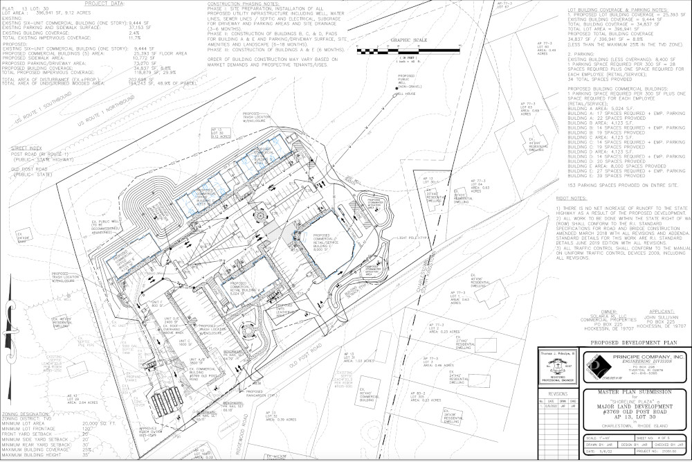
The next image is the proposed site plan with existing building on the left and the rest is all new.

The circle in the upper right of the above drawing is the well head protection area for the public well for the development. Public drinking water wells require a 200-foot radius of protected and undisturbed land, which would be located in the eastern undeveloped portion of the parcel. This wellhead protection area would leave more than 3 acres of the eastern side of the property wooded as long as there was a public well on the site. The wellhead protection area extends partly onto adjoining properties.
According to the meeting packet:
- Parcel identification is Map 13, Lot 30.
- Currently the parcel has one building with the rest mostly treed.
- The parcel is in Charlestown’s Historic District and Ground Water Protection District.
- The Parcel is in the CRMC area designated “Land Developed Beyond Carrying Capacity”.
- The parcel is located in the Traditional Village District (TVD) where a mix of commercial and residential is allowed.
- The application proposes commercial uses only.
- The original building would be upgraded and five new one-story commercial buildings, with a total of 25,393 square feet of building floor area, would be added.
- Buildings over 4000 sq. ft. in the TVD require a special use permit from the Zoning Board.
- The developer assumes one of the new buildings will be a pharmacy – a pharmacy can have a drive-through window and one is proposed and will require a special use permit from the Zoning Board.
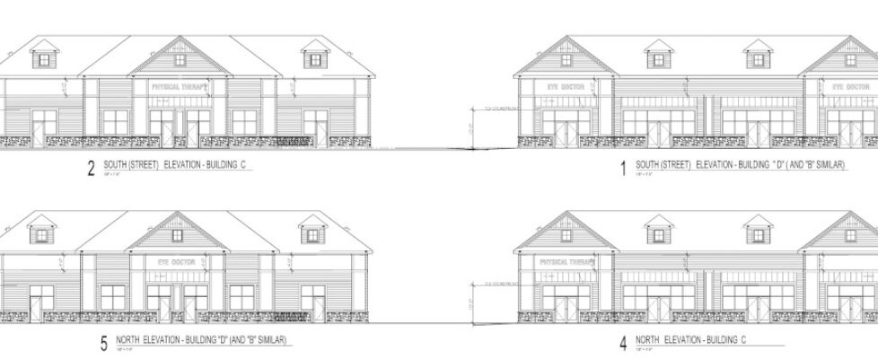
- The new buildings would be 28+ feet in height, but with only one story of floor space, and all the buildings would match in terms of materials, roof design and window placement.
- The parcel sits on Old Post Road, Rt. 1A, and backs up to Post Road, Rt. 1. It extends to the South Kingstown line where Rt. 1A joins Rt. 1.
- Architectural and Landscaping designs are in the meeting packet.
Also on the June 22nd agenda, is a Preliminary Plan presentation for a 4-lot residential frontage subdivision at the corner of Old Mill Road and Rt. 112 (Carolina Back Road).
- Location is Map 24 Lot 1-1.
- Except for its road frontage it is surrounded on all sides by the Francis C. Carter Preserve.
- Zoned R-40.
- Parcel is entirely wooded with no wetlands, but does contain steep slopes.
- A site walk will be scheduled during the discussion.
- A site plan is provided in the meeting packet.

Virginia Lee, the author of this post, was President of the Charlestown Town Council for the recent two terms that she served on the Council (2014 to 2020). She was the Town Council liaison to the Agricultural Commission, the Waste Water Management Commission, Coastal Pond Management Commission, Zoning Board of Review, Charlestown Potable Water Working Group, the Historical Society and the committee updating the Harbor Management Plan. She is a former member of South Kingstown’s Town Council, Zoning Board, and Conservation Commission. She is a former member of the Board of Trustees of the South Kingstown Land Trust and a former member of the Board of Directors of Save the Bay. She retired from the URI Coastal Resources Center in 2012. Virginia writes occasionally about the work of the Charlestown Planning Commission.

June 21, 2022 @ 7:50 am
How do you find site maps on the internet? I tried Mapexpress but link won’t open.
June 21, 2022 @ 9:24 am
This is link for this parcel https://charlestown.mapxpress.net/ags_map/default.htm?GIS_LINK=13-30