Tucker Woods Preserve Opens To The Public June 18
When: Saturday, June 18 at 10 a.m.
Where: Tucker Woods Preserve, between 639-719 Alton Carolina Rd. (Rt. 91) near the intersection with Hill Top Drive
What: Grand Opening Celebration with speakers, refreshments, tours and more by the Charlestown Conservation Commission
Charlestown purchased this property as protected public open space on September 30, 2021. The land was acquired with funding from a $400,000.00 Natural Heritage grant from the state and the remaining $500,000.00 in town open space funds approved by voters in a 2015 referendum.
Trails and parking have been developed and the land is now officially open for hiking! Because the property was funded with a grant from the Rhode Island Department of Environmental Management (DEM), public access and passive recreation is assured permanently.
The Charlestown Conservation Commission has been working hard since 2021 to layout trails and coordinate with Charlestown’s Department of Public Works, The Nature Conservancy, and the Charlestown Land Trust.
The 66.5 acres of mostly forested land lies along Alton Carolina Road (Rt. 91) between The Nature Conservancy’s Francis Carter Preserve and the State’s Carolina Wildlife Management Area.
Now that the preserve is officially open, you can walk the trails anytime between dawn and dusk.
The Rhode Island Natural Heritage Grant
On March 11, 2020, Janet Coit, who was then the Director of DEM, wrote to Charlestown’s Town Administrator to announce that our town had won a $400,000.00 grant for the purchase of the Tucker Woods property. This is the highest amount that can be awarded under the Natural Heritage Grant program. Charlestown had entered Tucker Woods in a competitive grant process with submissions from other towns and land trusts. According to Director Coit, “each application was evaluated and rated according to the rules and regulations established for the Local Open Space Bond Program. The most significant scoring factor was a measure of the project’s potential to protect and enhance Rhode Island’s natural, scenic, ecological and agricultural resources.” You can read the Rhode Island Natural Heritage Preservation Commission Scoring Criteria for Open Space Grants at the DEM website.
Tucker’s Location In A Conservation Corridor
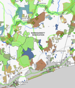
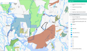
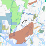
Tucker Wood’s location helps to fill a gap in a conservation corridor between the Francis Carter Preserve in Charlestown and the Carolina Wildlife Management Area in Richmond. Click on any image to open a light box to view the individual images.
This 66.5-acre parcel together with the Francis Carter Preserve now make up an 1,177.5-acre preserved area. The Carter Preserve is also contiguous with the Indian Cedar Swamp, an approximately 1,000-acre wetland parcel held in conservation for the Narragansett Indian Tribe. All of these lands, including the Tucker Woods property, are part of an 11-mile corridor of open space that extends from the ocean at Ninigret National Wildlife Refuge through the Carolina Wildlife Management Area.
Tucker’s Wetlands Are Tributary To The Pawcatuck River
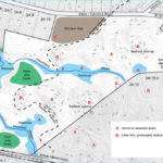
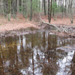
Streams on the Tucker Woods property connect Ice House Pond on the Carter Preserve to the Pawcatuck River. Click on any image to open a light box to view the individual images.
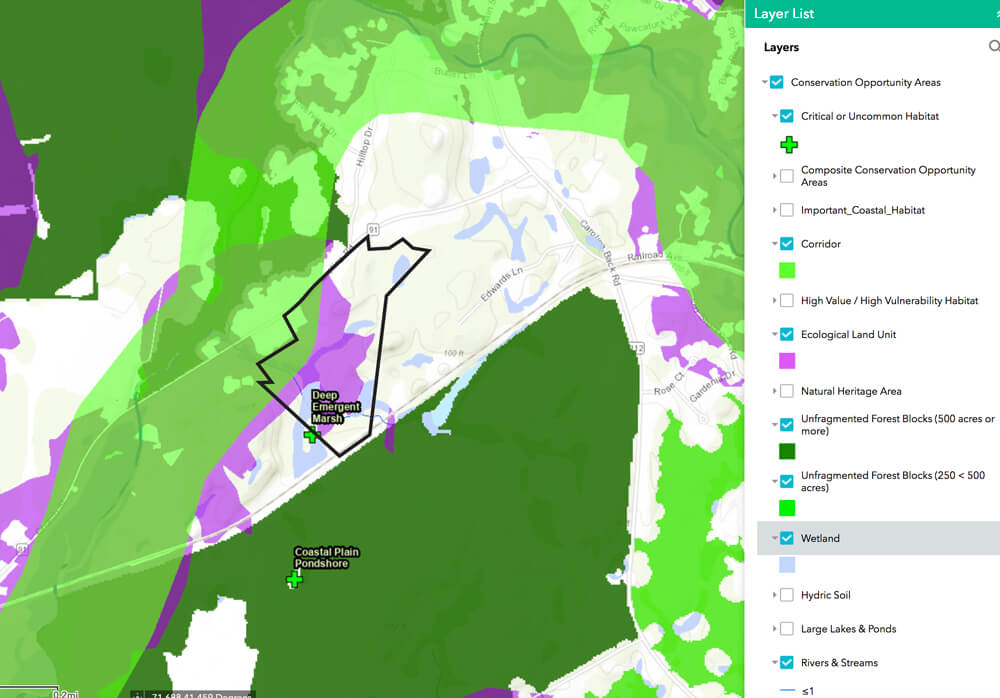
The property contains vernal pools, permanent and intermittent streams, and other wetlands. It shares a Deep Emergent Marsh with the Francis Carter Preserve. This marsh is listed as a critical habitat in state data and provides important nesting habitat for birds of high conservation value.
Tucker’s Ecologically Significant Habitat
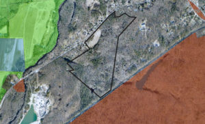
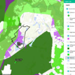
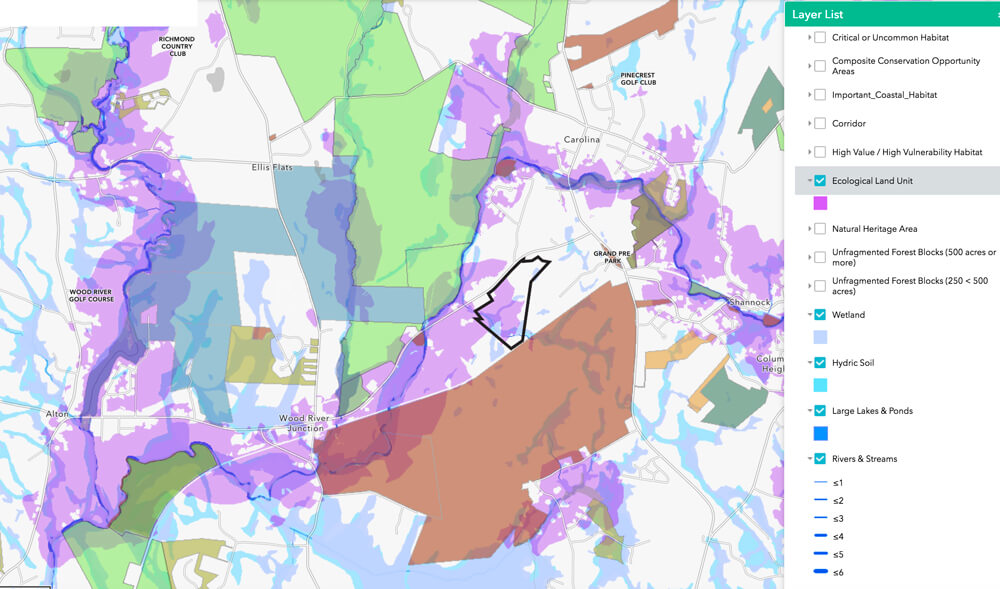
Much of the property is inside a state-mapped Ecological Land Unit (ELU) and a state-mapped wildlife corridor. An ELU is a landscape with a diversity of geophysical characteristics that supports diverse plant and animal communities. Species of state concern have been identified on the property. Click on any image to open a light box to view the individual images.
Some Ecological Land Units (ELUs) can be seen above in purple on maps provided by the state. These ELUs are associated with the Pawcatuck River and with the uplands near the river. The Tucker Woods uplands and wetlands are dominated by Ecological Land Units.
Tucker’s Wildlife
Signs of river otter and beaver have been spotted on the property, and many of the rare species that live on and move through the Carter Preserve will be protected by an expansion of preserved habitat in this area. The Charlestown Conservation Commission who have been working to develop trails note that you may see bald eagles, osprey, pileated woodpeckers, deer, lady slippers and many more on your hikes of the Tucker Woods Preserve.
Tucker Protects Views On A Rural Road
The preservation of the Tucker Woods property now protects over 1,500 feet of road frontage of forest and farm field along Alton Carolina Road (Rt. 91), a scenic rural state road.
Alton Carolina Road connects the National Register Village of Carolina with public access points on the Pawcatuck River, to Carolina Management Area in Richmond, and on to Westerly. The preservation of this parcel provides a forested frame for the village.
Tucker Protects Drinking Water Supplies
The property consists of over 66 acres of mostly forested land and wetlands that lie entirely within the recharge area of the Indian Cedar Swamp Groundwater Reservoir. Tucker Woods’ forests capture rainfall and cleanse rain to improve ground water quality.
Figures used above:
- Maps created using the RI Conservation Opportunities Map, which accompanies the Rhode Island Wildlife Action Plan.
- Vernal pool photographs by Linda Fabre.
- Photograph of Tucker’s farm field by Cliff Vanover.

You can learn more about the author, Ruth Platner, at her profile page.
June 6, 2022 @ 7:39 am
How would I get a map of the trails. Can’t find online. Thanks
June 6, 2022 @ 8:44 am
I don’t believe the town has published a trail map yet. The trails were just recently cut. They will have a kiosk at or near the parking lot so there will probably be a map there. In the future those will be at the town website. CCA has a guide to Charlestown open space at https://charlestowncitizens.org/guide-to-open-space/ , but we have not yet created an entry for Tucker Woods – we will soon.