Tucker Woods – Proposed Open Space Acquisition
UPDATE: The Charlestown Town Council voted to acquire this property as protected public open space at the April 12, 2021 Town Council meeting.
The Charlestown Town Council will hold a public hearing at their regular meeting on April 12 to discuss the potential acquisition of 66.5 acres of mostly forested land that lies along Alton Carolina Road (Rt. 91) between The Nature Conservancy’s Francis Carter Preserve and the State’s Carolina Wildlife Management Area. If the Town Council votes to preserve the land, it would be acquired with funding from a $400,000.00 Natural Heritage grant from the state and the remainder in town open space funds approved by voters in a 2015 referendum.
Click to join the virtual meeting at 7 pm on April 12 where the purchase will be discussed.
The Rhode Island Natural Heritage Grant
One year ago, on March 11, 2020, Janet Coit, the Director of the Rhode Island Department of Environmental Management (RI DEM), wrote to Charlestown’s Town Administrator to announce that our town had won a $400,000.00 grant for the purchase of the Tucker Woods property. This is the highest amount that can be awarded under the Natural Heritage Grant program. Charlestown had entered Tucker Woods in a competitive grant process with submissions from other towns and land trusts. According to Director Coit, “each application was evaluated and rated according to the rules and regulations established for the Local Open Space Bond Program. The most significant scoring factor was a measure of the project’s potential to protect and enhance Rhode Island’s natural, scenic, ecological and agricultural resources.” You can read the Rhode Island Natural Heritage Preservation Commission Scoring Criteria for Open Space Grants at the DEM website.
Tucker’s Location In A Conservation Corridor
Tucker Wood’s location helps to fill a gap in a conservation corridor between the Francis Carter Preserve in Charlestown and the Carolina Wildlife Management Area in Richmond. Click on any image to open a light box to view the individual images.
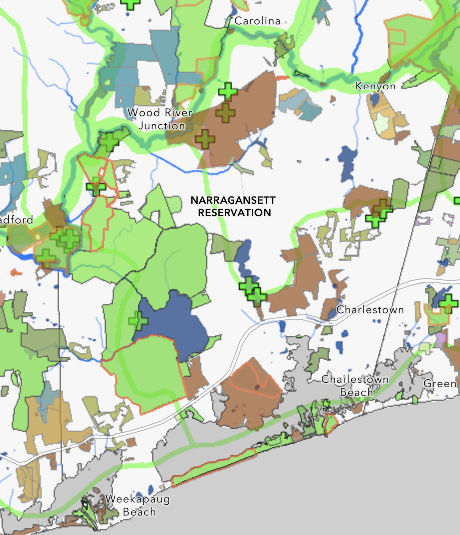
This 66.5-acre parcel together with the Francis Carter Preserve would make up an 1,177.5-acre preserved area. The Carter Preserve is also contiguous with the Indian Cedar Swamp, an approximately 1,000-acre wetland parcel held in conservation for the Narragansett Indian Tribe. All of these lands, including the Tucker Woods property, are part of an 11-mile corridor of open space that extends from the ocean at Ninigret National Wildlife Refuge through the Carolina Wildlife Management Area.
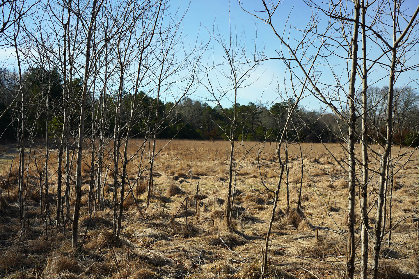
Tucker’s Wetlands Are Tributary To The Pawcatuck River
Streams on the Tucker Woods property connect Ice House Pond on the Carter Preserve to the Pawcatuck River. Click on any image to open a light box to view the individual images.
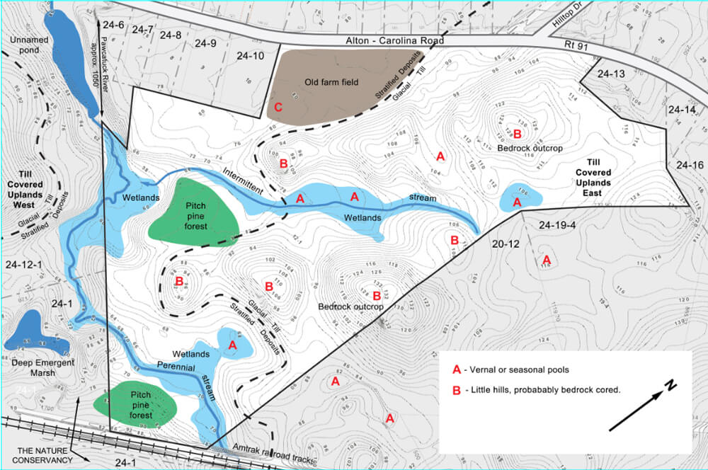

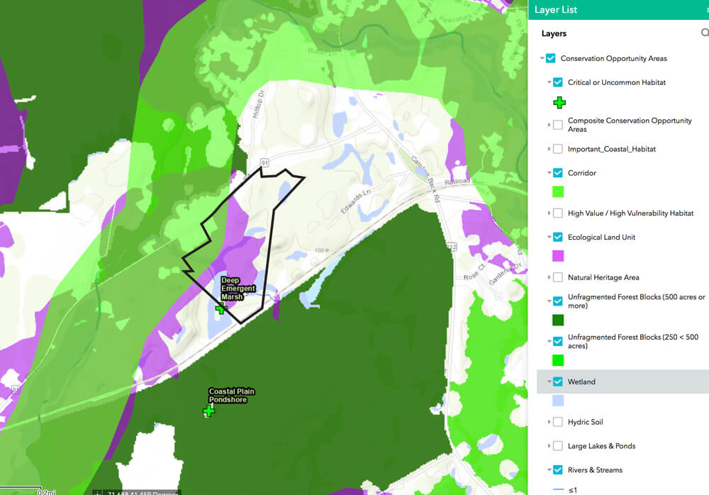
The property contains vernal pools, permanent and intermittent streams, and other wetlands. It shares a Deep Emergent Marsh with the Francis Carter Preserve. This marsh is listed as a critical habitat in state data and provides important nesting habitat for birds of high conservation value.
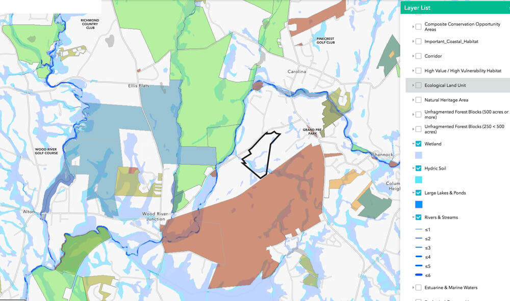
Tucker’s Ecologically Significant Habitat
Much of the property is inside a state-mapped Ecological Land Unit (ELU) and a state-mapped wildlife corridor. An ELU is a landscape with a diversity of geophysical characteristics that supports diverse plant and animal communities. Species of state concern have been identified on the property. Click on any image to open a light box to view the individual images.
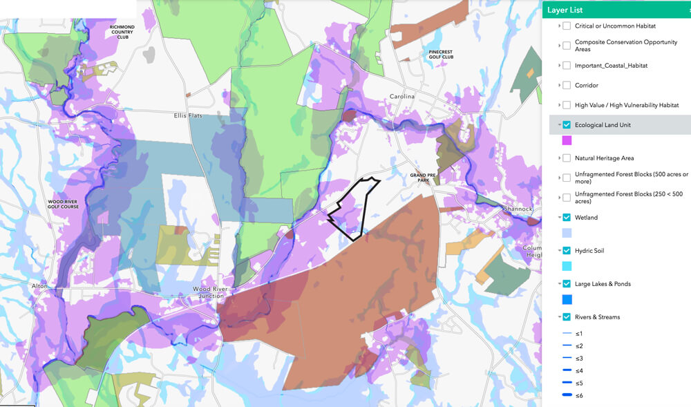
Some Ecological Land Units (ELUs) can be seen above in purple on maps provided by the state. These ELUs are associated with the Pawcatuck River and with the uplands near the river. The Tucker Woods uplands and wetlands are dominated by Ecological Land Units.
Tucker’s Wildlife
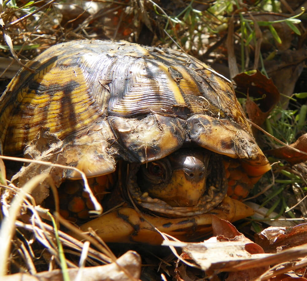


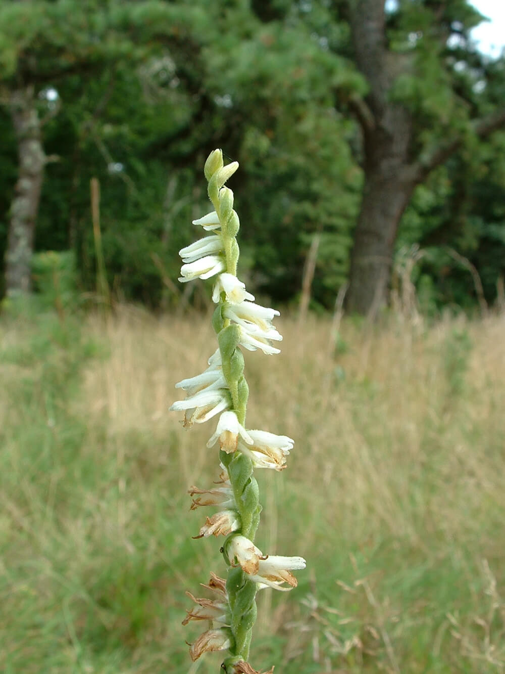
Above are the available photos of wildlife at Tucker Woods. Signs of river otter and beaver have been spotted on the property, and many of the rare species that live on and move through the Carter Preserve will be protected by an expansion of preserved habitat in this area. Click on any image above to open a light box to view the individual images.
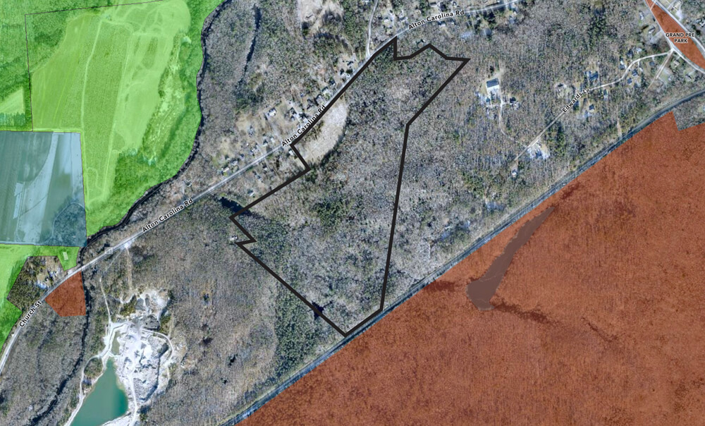
Tucker Protects Views On A Rural Road
The preservation of the Tucker Woods property would protect over 1,500 feet of road frontage of forest and farm field along Alton Carolina Road (Rt. 91), a scenic rural state road. Click on any image to open a light box to view the individual images.
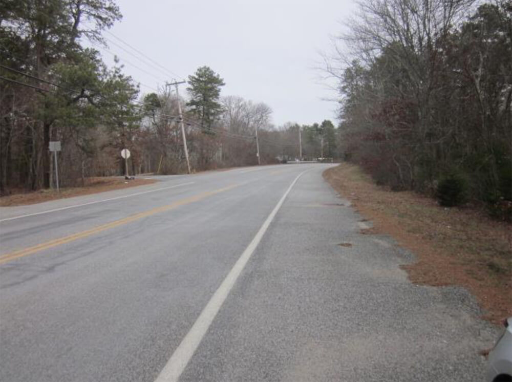
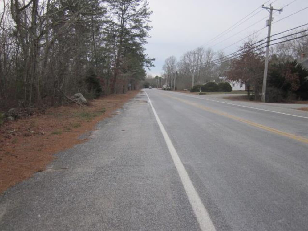

Alton Carolina Road connects the National Register Village of Carolina with public access points on the Pawcatuck River, to Carolina Management Area in Richmond, and on to Westerly. The preservation of this parcel provides a forested frame for the village.
Tucker Protects Drinking Water Supplies
The property consists of over 66 acres of mostly forested land and wetlands that lie entirely within the recharge area of the Indian Cedar Swamp Groundwater Reservoir. Tucker Woods’ forests capture rainfall and cleanse rain to improve ground water quality.
DEM Grant Ensures Permanent Public Access
Because the property will be purchased partially with a state grant, public access is guaranteed. There is an existing old cart path on the property that can be used as a hiking trail and other areas on the property where old trails can be revived or new loop trails created. Although the property connects to the Carter Preserve for wildlife, the two properties have wetlands and the train tracks at the border making through trails unlikely.
Fiscal Impact
The owner, who is also a developer, has asked for a total of $900,000.00. If the project proceeds, it would be acquired with funding from the $400,000.00 Natural Heritage grant from the state, and with the remaining $500,000.00 from town open space bonds approved by voters in a 2015 referendum.
If the project is not acquired for open space, the owner has promised to proceed with development. There is a yield plan showing 22 lots on the property. The land is split zoned with the 1,500 feet of frontage on Rt. 91, zoned for lots of less than 1 acre.
Residential development involves both revenues from property taxes and costs to the town for provided services, such as road maintenance and repair, police, recreation and all other new municipal costs, and tuition payments to the Chariho Regional School District.
- If the assessed value per new house works out to $450,000.00 to $600,000.00, the tax revenues would be $81,477.00 to $108,636.00 per year for all 22 homes.
- The costs of providing community services for a 22 lot subdivision are estimated at $142,943.68 to $227,587.36
- This would mean the net cost to the town to support the development would be approximately $34,307.68 to $146,110.36 per year.
- Avoiding these costs would mean the land will pay for itself in 3 to 15 years.
Drone Tour Of Property
Charlestown’s GIS Coordinator, Steve McCandless, prepared this drone video showing an aerial view of the parcel and surrounding area on Mar 23, 2021, before the trees had leafed out. The video is approximately 15 minutes long.
Figures used above:
- Maps created using the RI Conservation Opportunities Map, which accompanies the Rhode Island Wildlife Action Plan.
- Vernal pool and wildlife photographs by Linda Fabre.
- Photograph of Tucker’s farm field by Cliff Vanover.
- Photos of Alton Carolina Road from the appraisal done by Peter M. Scotti & Associates.

You can learn more about the author, Ruth Platner, at her profile page.
April 12, 2021 @ 3:11 pm
Awesome! We HAVE to do this! Especially as most of the $$$ was already given in grant form from the feds!
March 24, 2021 @ 12:37 pm
A chance to obtain another important property in Charlestown! Thank you Ruth and whoever else worked on the proposal – and thanks to everyone who has supported open space funding and acquisitions.
March 24, 2021 @ 10:04 am
Very interesting and well done. Hope it goes through.
I’ve heard that there someone is interested on installing solar farm on the old UNC land.
Also what is the status of the old Carroll products land?
Thanks.
March 24, 2021 @ 8:53 am
Sounds great, I hope that the town council decides to acquire it. Protected woodland open space like this is one of the main reasons that we love living in Charlestown …. along with so many others as per the pre-survey results.
March 21, 2021 @ 6:04 am
In a study done by Marion Clawson, supported by Resources For The Future, he estimated that the United States loses land equal to the size of Connecticut on an annual basis. The lost land is primarily converted into uses that historically cannot or will not ever revert back to its original state. Land conversions for residential, commercial, and industrial uses, water impoundment sites, and transportation uses are the major factors in this land loss. Charlestown has been fortunate in that it still has an abundance of open and forested acreage. It is one of our most valuable resources. Unless this land is somehow protected, it could end up as one of the many examples of land lost to our children and their chidren.