Charlestown Open Space Project On Council Agenda
The Rhode Island Department of Environmental Management(DEM) announced on February 28, 2020 that Charlestown’s Open Space Grant application had scored very high and had been selected for funding. After a year, this property, known presently as Tucker Woods, is finally back before the Town Council.
Land proposed for protection under the Natural Heritage grant program is scored for its protection of critical and uncommon habitat, its capability of supporting a diversity of habitats, its support for rare or endangered species, its close proximity to other protected land, its close proximity to a river or other water body, groundwater protection, and public access for passive recreation.
According to last year’s DEM press release, Charlestown was awarded the $400,000 grant towards the purchase of the Tucker Estates property which contains “66.5 acres of pitch pine forest in a column of nearly contiguous open space that extends from the coast at the Ninigret National Wildlife Refuge to the Carolina Management Area in Richmond. Its streams are tributary to the Wild and Scenic Pawcatuck River, and its field, pitch pines, oak forests, vernal pools, and rock outcrops provide habitat for species of state concern. With nearly 1,500 feet of frontage on Rt 91, it provides a rural landscape of field and forest along the scenic road and creates a forested frame for the National Register Carolina Village. Once owned by the town, it will provide public hiking and other passive recreation opportunities.”
Other costs associated with the purchase would likely be funded by the town’s open space bond fund which was approved by Charlestown voters in 2015. The approval of the DEM grant was just the first step in preservation of the property.
On the Town Council agenda for Feburary 8 is a vote to allow the Town Administrator and Town’s attorney to negotiate a price for the property. DEM also has to approve the price and will not be involved in the sale if they believe the price is greater than the market value. If a sales price can be negotiated that the seller, town and DEM all agree on, the Town Council will hold a public hearing at a future meeting and then vote on the purchase.
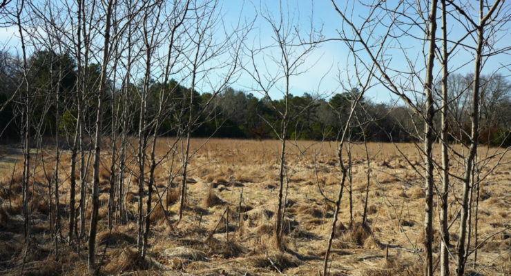
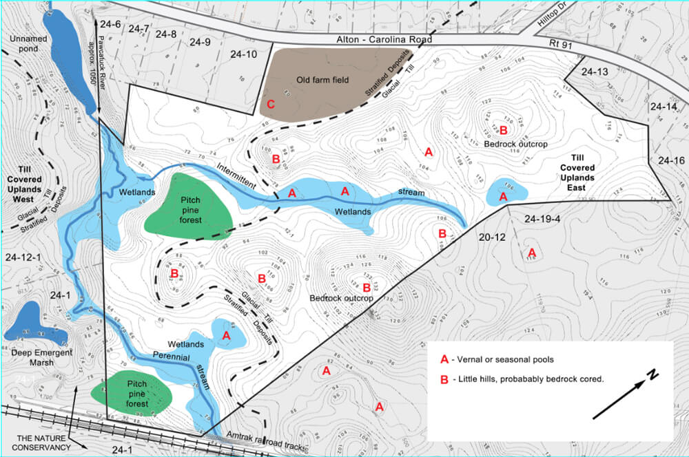
The map below is based on a survey of the property and shows the 1,500 feet of frontage on Rt 91, a part of which is the field pictured in the banner image for this post.
In an earlier post I described conservation corridors that stretch from the barrier beaches of Charlestown to the border with Massachusetts in Burrillville and then beyond to the mountains of northern New England and Canada. The Tucker Woods property is an important link in that chain of open space.
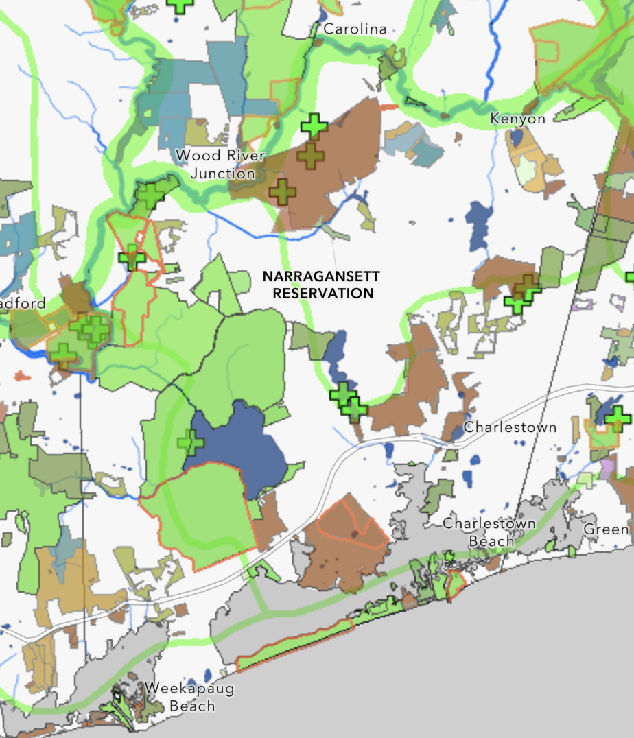
Below is a map showing Charlestown’s Conservation Corridors and protected open space. The Pawcatuck River forms the northern border of Charlestown. The brown area south of the river is the Carter Preserve and the green and blue lands areas north of the river are part of the state’s Carolina Management Area. The green crosses “+” depict the location of areas of critical or uncommon habitat.
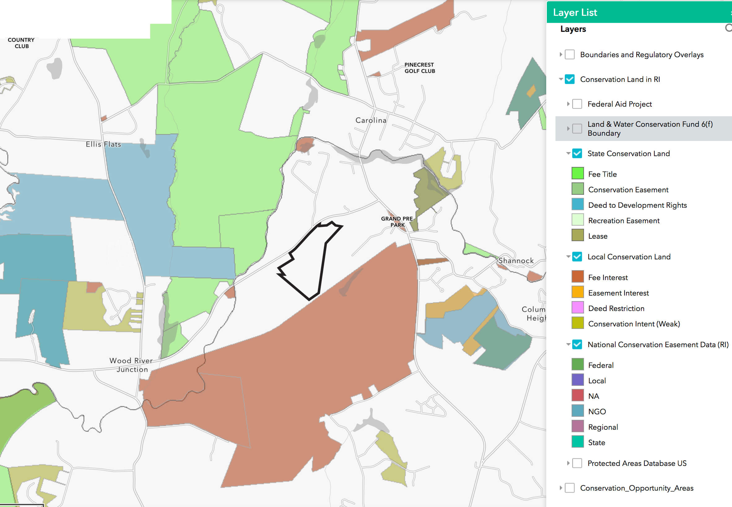
 The map below shows the location of the Tucker Woods property outlined in black between the Francis Carter Preserve (brown) and the Carolina Management Area (green and blue blocks).
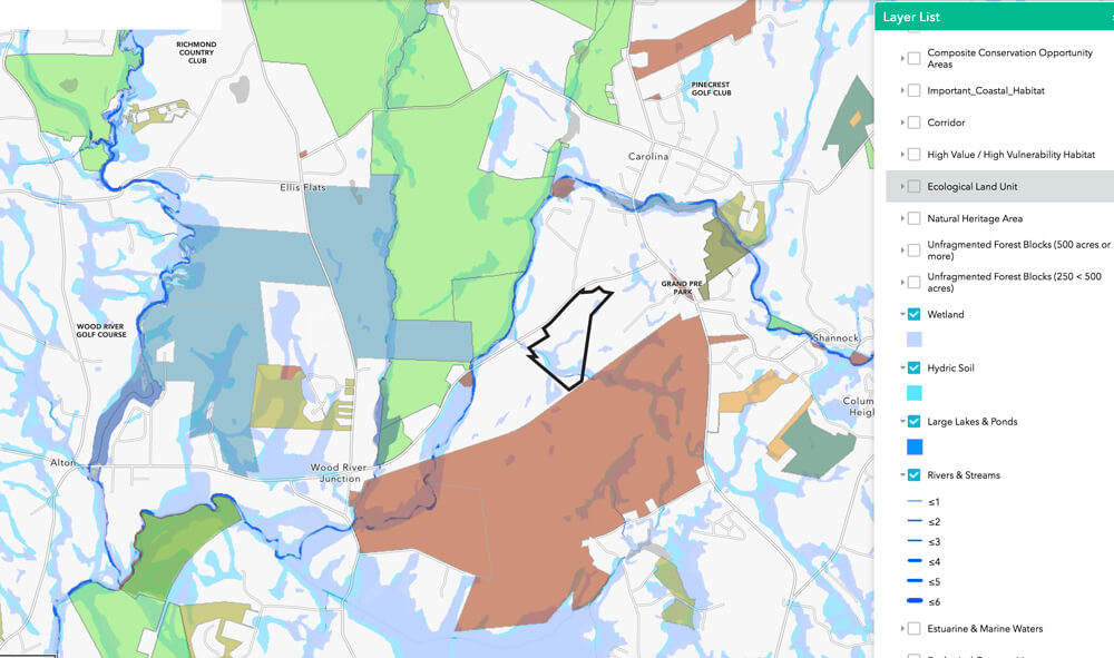
 The next map illustrates how the Tucker Woods property could protect the wetlands and stream that connect Ice House Pond in the Carter Preserve to the Pawcatuck River.
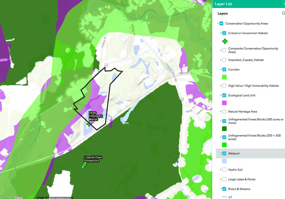
 The following map shows Ecological Land Units in purple.
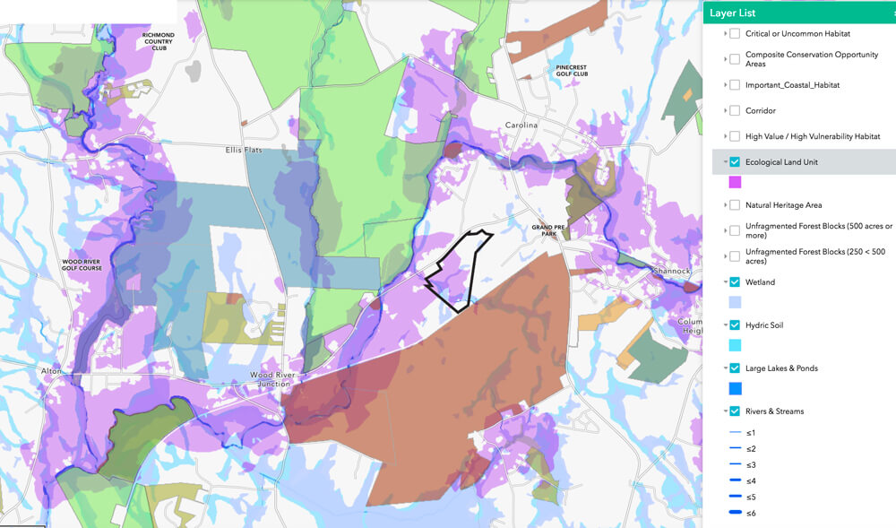 Ecological Land Units (ELU) are land types that typically support large numbers of plant and animal species. A specific ELU has a unique combination of soils, geology, landform, and elevation. An area with many different types of ELUs will have many different types of plant communities, thus high biodiversity. These are the areas mapped in purple on the above map. The Pawcatuck River has many ELUs associated with it. The Tucker Woods property has wetlands in close proximity to the Pawcatuck River, vernal pools, areas of steep slopes, open grasslands, pitch pine forests, and other forested areas. All these different land types close together support diverse wildlife communities.
Below is another look at the Tucker Woods property’s position in a conservation corridor that is rich in critical habitats and home to species of state concern.
The Tucker Woods property currently contains an old farm road that can be used as a hiking trail. Other trails could be created to allow more enjoyment of the property by hikers.
The Tucker Woods property helps to fill a gap in protection between the Francis Carter Preserve and the Carolina Management Area. If this property is protected, it will help maintain the ecological integrity of the corridor of open space that stretches from the beaches of Charlestown to the border with Massachusetts.

You can learn more about the author, Ruth Platner, at her profile page.
The banner image is a photograph of part of the field along Rt. 91 in the Tucker Woods property
February 22, 2021 @ 9:49 pm
Beautiful!
The most important initiatives that we can support are those of land and wildlife conservation.
February 11, 2021 @ 2:02 pm
I support any opportunity to save our land for wildlife and healthy hiking.
February 10, 2021 @ 11:53 am
Looking forward to many walks on another beautiful town-owned property. Two thumbs up!
February 9, 2021 @ 5:31 pm
Looking forward to many walks on another beautiful town property, especially one as diverse as this. Two thumbs up!
February 8, 2021 @ 2:32 pm
We support it …. John and Frances Topping
February 8, 2021 @ 10:42 am
This is a unique opportunity to take advantage of state funding to conserve an amazing diversity of habits for this and future generations. It is a rare chance to link up wildlife corridors and hiking trails for enhanced recreational use by Charlestown residents. Let’s support this initiative!