Charlestown Remains Connected To The Forests of Burrillville
The following is shared with us by the author Ruth Platner. Ruth Platner is Chair of the Charlestown Planning Commission.
Charlestown’s intervenor status on the proposed Invenergy power plant was granted exclusively on the water withdrawal issue. Now that the Narragansett Tribe and Invenergy have terminated their contract to truck water from Tribal land in Charlestown to Burrillville to cool the turbines of Invenergy’s proposed power plant in the forest of that town, Charlestown has lost its intervenor status. That is great news for the wetlands of the Indian Cedar Swamp and for anyone who lives or travels in the path of the proposed tanker truck caravan. Yet despite escaping this threat to our local roads and wetlands, Charlestown remains connected to the forests of Burrillville in several important ways.
In his testimony on the Invenergy power plant’s environmental impacts, Scott Comings of the Rhode Island Nature Conservancy explains that the power plant would produce “significantly negative and unacceptable harm to the ecological integrity” of part of a corridor of open space that stretches from the beaches of Charlestown to the border with Massachusetts in Burrillville.
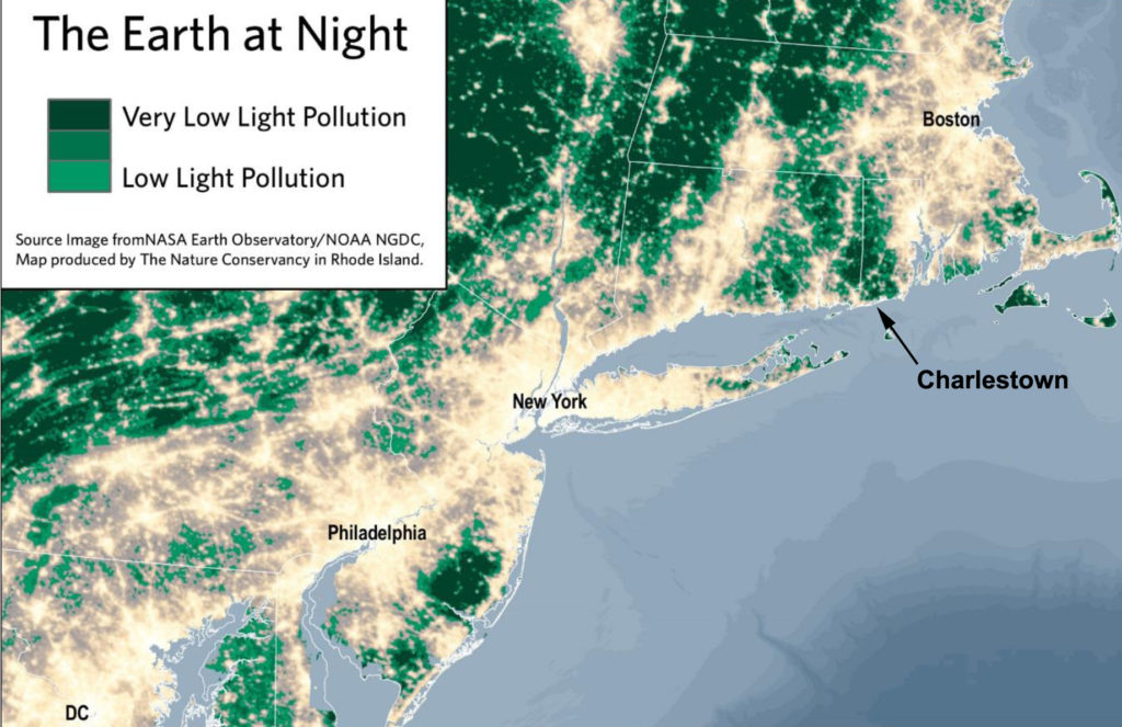
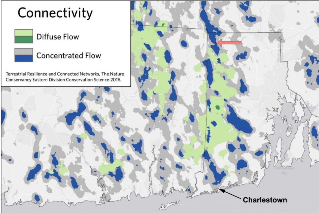
Scott C0mings referenced regional maps of low light pollution and open space connectivity. In both figures, Charlestown makes up the southern terminus of this important wildlife and conservation corridor and Burrillville occupies the northern end. I have annotated those maps with Charlestown’s position and included them below.
The “Earth at Night” graphic shows areas of low light pollution in green. Locate Charlestown on this map and then follow the green column to Burrillville at the Massachusetts border. These are the darkest, least developed areas of Rhode Island. And in the regional context, it is part of the only undeveloped area along the Eastern Seaboard that connects the Atlantic Ocean to the inland forests of New England and Canada. Looking at this map you can see how important Ninigret National Wildlife Refuge is to birds migrating along the Atlantic Flyway. After days flying near some of the biggest, most brightly lit metropolitan areas in the world, Ninigret offers migrating birds the first true darkness and a gateway to miles of relatively unfragmented open space on their journey north.
The second figure, labeled “Connectivity” from Scott Comings shows patterns of ecological flow. “The areas of diffuse and concentrated flow are ecologically valuable and are good targets for conservation. Blue concentration zones can be particularly valuable as conservation priorities due to their irreplaceable nature.” The white areas of the map (areas that are not blue, dark gray, or green) show barriers to wildlife movement. ( You can read Scott Comings’ entire testimony at the EFSB website.)
Again Charlestown provides the coastal gateway to this important wildlife corridor. At the northern end, the map displays a red arrow pointing to a red block showing the footprint of the proposed power plant. The wildlife corridor is narrow at this point and the plant’s footprint would block the corridor and result in habitat fragmentation.
The blue areas on the map are where species movement is concentrated in a narrow area. These are unique pathways where alternative pathways are not available. If these unique pathways are lost, the conservation areas become islands, no longer connected to the forests of Northern New England. Both Charlestown and Burrillville are dominated by these irreplaceable wildlife corridors depicted in blue on the maps. If the power plant is built in Burrillville it will block the wildlife corridor and greatly reduce connections to the northern forests beyond Rhode Island.

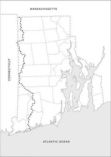
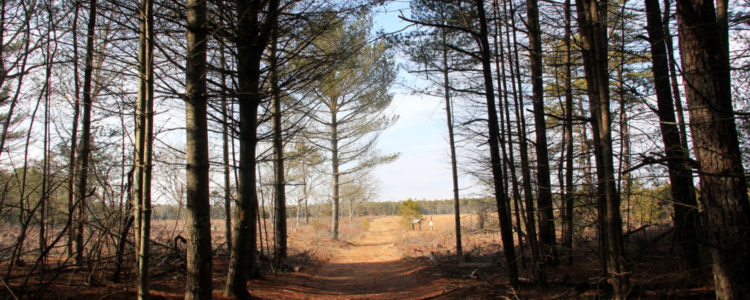
This same wildlife and conservation corridor provides the path of the 77-mile long North South Trail, Rhode Island’s premier hiking trail. The North South Trail begins in Charlestown at Blue Shutters Beach and passes through Burlingame, Carolina, and Arcadia State Management Areas and then follows the western edge of the state through other preserved land in Exeter, West Greenwich, Coventry, Foster, Glocester, and Burrillville. The trail ends at the border of Massachusetts at Buck Hill Management Area in Burrillville where it joins the Midstate Trail through Massachusetts and eventually the Appalachian Trail. If the Invenergy Power Plant is built in Burrillville, you’ll be able to see the 1000 Megawatt gas and diesel power plant from the trail.
Both Charlestown and Burrillville contain critical wildlife habitats and recreation areas and are important in their own right, but in a regional context they are even more important. Fragmentation at either end of this corridor diminishes the importance of the entire corridor for both wildlife and recreation.
Charlestown is connected to Burrillville by the North South Trail and by a corridor of Rhode Island’s most rural areas, with large tracts of contiguous forest, rivers, wetlands, and important wildlife and outdoor recreation areas. The arguments we made in the effort to stop the transformation of our conservation lands to a transportation use for high speed rail are similar to those being made against siting a power plant in a wildlife corridor. Charlestown’s natural resources are important, but that importance is greatly magnified by connecting our coastal conservation areas to northern forests.
Charlestown may have lost its intervenor status and a seat at the legal table, but our town still has a lot at stake in the Invenergy power plant issue!

Visit Our Water Withdrawal Page For More On This Issue


January 7, 2019 @ 1:56 pm
Thank you for putting this into context for the people of Charlestown!
February 1, 2018 @ 12:13 pm
It is so important to make this information widely known. It is one more thing that makes Charlestown such a special place. Thanks very much for shedding “light” on the matter!
February 1, 2018 @ 10:28 am
Thank you Ruth for your support and a great article. We have long been trying to have the EFSB see all the negative sides to the environmental impact this power plant will have on the whole state.
Hopefully the DEM will come out strong against it.
We hope you sent this to the EFSB to consider. We wish Charlestown still had intervenor status so you could continue your support, but this will help. Thank you again.
February 1, 2018 @ 11:31 am
I need to put this in a different format to send to EFSB, but yes I will send it to them.
January 31, 2018 @ 11:16 am
Thank you Ruth for your continued involvement bringing the need to keep our precious and sensitive environmental corridor in tact and in the forefront of issues to those in authority to make a difference.