Ken Payne: Staying With The Curves
This beautiful essay by Ken Payne makes the case that keeping our curvy train tracks and the natural and historic landscapes the train passes through are vital to Rhode Island’s future. It’s a must read for anyone interested, involved, or impacted by the “Old Saybrook to Kenyon Bypass”. You can learn more about Ken Payne at his profile.
Stay with the curves: they are an asset.
Riding the train from Kingston to Westerly, looking out the window one sees scrubby woodlands, houses, nineteenth and early twentieth century mill housing and the single family homes of late twentieth century suburbanization, farms, and wetlands, swamps, and streams; the train goes over the Pawcatuck River and its tributaries eight times, –things deeply familiar to us who live here, no vast or grand vistas that are breathtaking, but something that is, at both the natural and human scales, intimate. Southbound the curves come at the villages of Kenyon and Shannock, after Wood River Junction, after Burdickville, and three miles before Westerly Station.
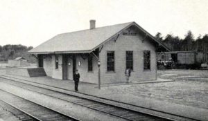
This association of the curves with places might lead one to think that the railroad was given the course that it has to serve emerging nineteenth century mill villages, yet the railroad dates from 1837 (a corporate charter was granted by the General Assembly in 1832), the villages are of the 1840s, Carolina 1841, Kenyon 1844, and Shannock 1848. Looking at topographical maps reveals that the rail alignment avoided hills (in the 1830s there wasn’t the capability to move earth that we have today) and stayed on drier ground where possible. The curves were a sane response to topography, and taking those curves, which are fairly gentle, one feels the landscape; the track down from West Kingston to just before Kenyon is straight and the train whizzes along, the curves provide a slight change in sensation that signals that one might look up for a moment and take in what one is going by.
The ride from Kingston Station to Westerly Station takes 14 minutes. Throughout, the train moves at a good clip; the conductor says it goes 90 miles per hour. A straight-shot bypassing the curves would allow speed of 150 miles per hour in stretches. At that speed the passing, intimate scene would be a blur. The slight slowing and bending with the curves would be gone, and gone too would be a signal to pause and look out for a moment at ordinary life in southwestern Rhode Island.
Pausing and reflecting are healthy and pleasurable activities. They make life richer and more enjoyable. In many instances people will pay a premium to have a better experience. Starbucks recognized when establishing its chain of coffee shops, the product being offered was in part a few pleasantly relaxing minutes, for many people a brief oasis in a hectic day.
Unexpected delays in travel are unsettling; we like things being on schedule–it makes planning possible; a trip that takes a couple of minutes longer in Rhode Island is an inconsequential difference: being on time is what is valued.
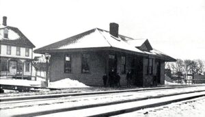
Straight lines are easy and efficient when the terrain is flat and relatively undeveloped. This was the case from Kenyon northeast to West Kingston, and from West Kingston more northerly to East Greenwich in the early 19th century. Thus there are to this day long sections of track in Rhode Island that are flat and utterly straight, indeed some of the highest passenger train speeds reached in the US are achieved in Rhode Island. But imposing straight lines comes with costs when the terrain is varied, uneven, and dense with human activities and purposes. This is the actuality between Kenyon and Westerly.
The terrain is moraines, rock and earth left in hills and ridges by the receding glaciers of the last ice age. On this terrain an average of over 40 inches of rain falls annually, feeding streams and a river system that empties into Rhode Island sound in Westerly. Since the Stonington to Providence railroad was established, one hundred eighty years of development have occurred. The area has a distinctive character and identity. It is a place.
Landscapes are important to the people who inhabit them. They are the physical context in which the people live, and they supply cultural meaning. A lot is contained in the simple question, “Where are you from?” The response congers up a place, a culture, and a history, including a personal history. Places are the integrated reality of ecology, history, and culture. Put another way, places are reservoirs of embodied understanding, which are aggregated and visualized in landscapes.
Southwestern Rhode Island, where the proposed by-passing of curves would occur, is an area with two distinctive terrains, each recognized as ecologically significant, coastal salt ponds and barrier beaches and moraines, hills valleys, streams and the Wood-Pawcatuck River. One a coastal environment, the other an inland environment, US Route 1, almost precisely the dividing line between the two, closely follows the path of the Boston – New York Post Road, which dates from the eighteenth century. The entire area was once Westerly. Westerly (1669) with Kingstown (1674) were the two original towns of Kings Province (1654), which became Kings County (1729) and was renamed Washington County in 1781. As Westerly and Kingstown grew in population in the eighteenth century, they were subdivided through the chartering of new towns. The eastern portion of Westerly became Charlestown in 1738, and the northern half of Charlestown became Richmond in 1747; the northern part of Westerly became Hopkinton in 1757. Affectionately, Washington County is called “South County” and is thought as a place where life isn’t so rushed, so hustle and bustle as life in and around the City of Providence is. South County beaches are where people come to relax and vacation.
The inland portion of old Westerly, before suburbanization, was a place of farms, quarries, and mill villages. So the coastal and inland areas are distinctive historically and culturally as well as ecologically. The coastal area has attracted the affluent for more than a century, while the moraine inland area has been more working class. The great expansion of the middle class since World War II affected both areas, but the coastal area gained in greater affluence.
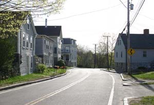
While most of the mills are gone, the mill villages are historic, and much of the housing built for workers remains. This housing stock is important. In Rhode Island, there is a chronic shortage of low and moderate-income housing. The housing market does a good job meeting the needs of households with upper middle incomes and above. The need for low and moderate-income housing is recognized in state law, by Rhode Island Housing, and in the state’s housing plan. Mill housing is thus both a historic resource and a currently valuable form of housing supply in this area of the state. It is a village setting for working households.
What holds throughout old Westerly is a dedication to preservation. As a consequence, suburban sprawl has not been overwhelming. In each Town there is an active land trust, Westerly itself has two. In addition, the Audubon Society and especially The Nature Conservancy have major holdings. The Federal presence is found in the coastal area, the Ninigret National Wildlife Refuge. The State’s coastal area presence is two beaches, Misquamicut and Ninigret; its major inland presence comprises Burlingame State Park and Management Area, Carolina Management Area, and Arcadia Management Area, Woody Hill Management Area in Westerly, and Hillsdale in Richmond.
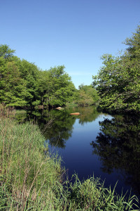
The Wood-Pawcatuck River system has 57 miles that are paddleable by canoe or kayak. Many of the old mill dams have been removed to enable fisheries restoration. Unusually pristine for a river system in the Boston to Washington megalopolis, the Wood-Pawcatuck is being considered for a Federal Wild and Scenic River designation. The Wood-Pawcatuck Watershed Association has been the most vibrant local rivers council in Rhode Island.
Finally and profoundly important, the tribal lands of the Narragansett are in central Charlestown. The whole of South County was Narragansett Country when European settlers arrived, gained a foothold that before the end of the seventeenth century became dominance. Throughout this region of Rhode Island there are remnants of pre-European ways of life, often they are not much talked about for fear they might be disturbed. Native burial sites are sacred ground that compels our respect and veneration.
During the half century, from the end of World War II to the millennium (2000), the acreage in Rhode Island devoted to agriculture declined by 80 percent. The highest levels of losses occurred during the first three decades of this period. Rhode Island saw what was happening and made agricultural preservation a State priority. The Farm Forest and Open Space program was enacted in its present form in 1980; the Farmland Preservation Act was passed in 1981, and in 1982 the Right to Farm Act became law. These three major enactments made keeping land in farming an affirmative public policy. In the early 1990s a farmers’ market movement took off. Now there are farmers’ markets throughout the state, and Rhode Island became a national leader in direct to consumer sales by local farmers. The 2007 Census of Agriculture brought good news, the amount of land in Rhode Island in active agriculture had increased and the number of farms, especially small farms, had increased sharply. Another round of policymaking followed in 2011-2016, Rhode Island committed to building a vibrant agricultural sector as important to the state’s future. There are farms scattered through the four towns of the old Westerly. Their presence is a vital component of the working landscape.
The Rhode Island Food Policy Council and the state’s Interagency Food and Nutrition Policy Advisory Council have embraced Food Solution New England’s Vision that 50 percent of the food consumed in the region should come from within the region by the year 2060. This would require a huge increase in agriculture production in New England. Rhode Island seeks to be part of that growth. Since Rhode Island is densely populated and cannot increase its land area, this means that existing farmland needs to be kept in agriculture and used more productively.

Farmlands are at the heart of the idea of working landscapes–landscapes that at once are beautiful, sustain environmental functions and open space and are economically productive. Agriculture provides an ecosystem service, a benefit to people. Ecosystem services are multifold. The ecosystem provides the nutrient cycling and soil formation on which life depends; it supplies food, water, and raw materials such as wood for lumber; it has cultural, spiritual, and therapeutic values, it is a place of recreation and of scientific studies and education, and it filters pollution and absorbs wastes, from run-off and to carbon emissions. Our civilization has reached a time when natural areas must be protected because of the ecosystem services they provide. Thought of this way, it can be seen that the preservation efforts that are widespread in the old Westerly area make possible the quality of place and life that is enjoyed here. They protect water supply, they secure farmlands from development, they provide abundant recreational opportunities, hiking trails, canoeing, kayaking, and boating, they are places of solace and spiritual rejuvenation and of field studies for scientists and outdoor classrooms for students. They make this part of “South County” outstanding as something other than wall-to-wall suburbanization.
Rhode Island has long been a place that has championed high-speed rail. In 1966, U.S. Senator Claiborne Pell authored a book, Megalopolis Unbound, which laid out the arguments for high-speed rail, especially in the northeast corridor. His view was that the region, with 1.4 percent of the nation’s land area and 20 percent of its population, would suffer “massive strangulation” due to traffic jams. He envisioned use of train technology that would go 160 miles per hour on straight stretches and 110 miles per hour on curvy ones, such as those found on the “winding lines of the New Haven” (the New York New Haven and Hartford Railroad, a system absorbed into Amtrak). Senator Pell was the longest serving Senator in Rhode Island history. When Kingston Station experienced a fire late in his career, he threw his full support into its restoration rather than having it replaced by a new modern station, which is what Amtrak wanted. That restoration was accomplished with the passage of the Intermodal Surface Transportation Efficiency Act (ISTEA), an effort in which Senator John H. Chafee was a leader. Both Senators were stalwarts in environmental protection and natural area preservation, indeed preserved open space is one of Senator Chafee’s great legacies in this state.
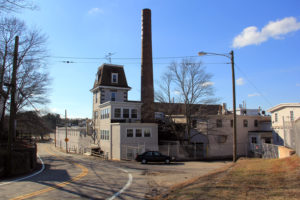
As recently as the first half of the 1970s, there was commuter rail from Westerly through Providence to Pawtucket. The “508’s” stops going north were Westerly, Shannock, Kingston Station, Wickford Junction, East Greenwich (where former Governor John H. Chafee would sometime board), Kilvert Street in Warwick, and Providence Union Station, where one could cross the platform and climb on the Boston local of the old New Haven railroad (which had been merged into the Penn Central in 1969) and get off on a platform of the by then derelict Pawtucket-Central Falls station. An era was drawing to an end. The US was becoming a post-industrial economy. Gritty factories were closing one after another. Places became successful by being competitive in the “knowledge economy.” And quality of place has proven vital in attracting and retaining knowledge workers. In this competition environmental health and amenity are necessities.
Increasing the capacity of the rail line is a major justification for the bypass. Yet capacity is not just a function of the number of tracks but also of how efficiently tracks are used. The length of trains and platforms can be increased to accommodate more travelers. Head times between trains can be reduced by use of advanced GPS technology. Trackage can be augmented; as was done with the freight rail improvement project, which enabled the re-establishment of commuter rail service to Wickford Junction. Increasing capacity makes sense only to the extent that there is increased demand, service, or as is necessitated for public safety. Trying to induce demand by increasing supply is risky. It is not uncommon for projects undertaken in the belief that “build it and they will come” turn out to be white elephants. Historically many railroads failed because they could not sustain profitability. The modes of transportation that people actually use are not only the products of technological capability but also the outcomes of cultural preference. The justification for the bypass in southern Rhode Island essentially assumes that evolution of the cultural demand for increased rail service will occur more rapidly than the evolution of technology enabling more efficient use of existing rights of way.
Rhode Island is the smallest and second most densely populated state in the US. Here land is a precious resource, typically devoted to specific uses that are culturally important and frequently ecologically vital. There are no wide-open spaces, no room to spare, no great blank slates on which anything one wants might be written. Reuse of existing structures is the means Rhode Island has, to promote its continuing vitality. The offices of the Rhode Island Commerce Corporation are located in a converted industrial building of the American Locomotive Works in Providence. Our future in Rhode Island substantially depends on the creative and effective reuse of existing structures.
We are now confronted by a need to curtail greenhouse gas emissions and mitigate climate change. The coastal portion of old Westerly is severely threatened by sea level rise. Transportation is one of the top energy uses in Rhode Island. The Executive Climate Change Coordinating Council, a statutory body called the “EC4” for short, in its December 2016 report shows the transportation sector as accountable for 40 percent of the greenhouse gas emissions in the state. Rail travel, especially when it is powered by electricity, is one of the very most energy efficient modes of travel—this holds true for both high speed and normal speed intercity rail, bicycling is the only other mode of travel that achieves the same efficiency, but it is much slower. Since the need is to reduce greenhouse emissions as quickly as possible, use of the curves, while maybe costing a couple of minutes in trip times, can be accomplished much more quickly, with less complex engineering, land acquisition, and construction work. In many respects a straight-line solution would be costlier and more time and energy consuming, to what actual benefit?
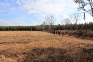
There is an advantage in designing with nature. If the curves weren’t already here maybe that advantage would not be readily at hand. But the curves respecting topography are in place. They are part of a historic landscape. They are the path of least resistance. They can be used with economic efficiency. They are in this respect too an asset.
The present inland landscape of old Westerly is like a quilt. It is a fabric composed of many parcels of different shapes, sizes and colorations all bearing the imprint of human volition. The quilt of landscape has been stitched together over time by many hands working in ways personal and individual, familial, commercial, civic, and governmental.
A homeowner tending her yard, a farmer planting a field, a woodlot owner managing a forest, a builder constructing housing and commercial structures, a land trust protecting open lands and natural areas, a town government managing water supply, a tribe maintaining the sacredness of the land, these are pattern making activities that comprise an ever changing quilt of land uses that speak to us and convey the comfort of place. Some parts of this quilt are hard or impossible to replace: places with collective historic meaning, natural heritage locations, and large unfragmented parcels providing ecosystem services. Overall, a failure to respect the pattern language of landscape is a form of transgression.
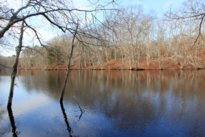
The straight line solution offered in the Old Saybrook to Kenyon bypass would impact public drinking water supplies in Westerly, tear through major nature preserves (Grills and Carter), require tunneling, cut important farms in two, slice into Narragansett Tribal lands, and obliterate mill village housing, significantly Columbia Heights. In sum it would negatively impact ecosystem services, sunder historic resources, and dramatically alter the landscape through which it passed.
Landscape is a means of transmission of culture from one generation to the next. Each of us is influenced by where we live. Places convey both opportunity and meaning. They shape who we are. Our childhood grounding in place informs our values as an adult. How powerfully we remember the place of a happy time with a grandparent. Without such memories we would not be who we are. To be clear places convey values that are heritable. Species evolve, cultures evolve, and landscapes evolve. These evolutions make possible futures that are different from the present. Yet evolution does require that characteristic of one generation can be passed to the next. This holds true for culture and for its physical expression in landscape. History provides meaning that informs our identity and enables us to understand ourselves as individuals, as family and community members, and as part of a nation. History is cohesive. The landscape of the old Westerly is important in precisely this regard, and the curves in the track are a key part of the historical landscape. In this respect too, they are an asset.
So staying with the curves makes sense. It can add a note to the quality of the travel experience. It can respect ecosystem services and be an instance of “designing with nature”. It can provide an efficient means of advancing railroad transportation and mitigating greenhouse gas emissions. It can conserve the quality of the historic landscape so that future generations can be informed by the experience of place. In can contribute to quality of place and knowledge economy competitiveness. In twenty years the curves will have their 200th birthday, while they have certainly changed with time, they can still be a vital presence. What more positive outcome could one ask for than this?

Ken Payne is a student of the history of the structure of Rhode Island government and a recipient of a lifetime achievement award in 1998 from the Environment Council of Rhode Island for his work on rivers policy and protection. You can learn more about Ken at his profile.
Sources/ References
Alexander, Christopher et al. A Pattern Language, Towns, Buildings, Construction. New York: Oxford University Press, 1977.
Cannavò, Peter E. The Working Landscape, Founding, Preservation, and the Politics of Place. Cambridge, MA: The MIT Press, 2007.
Best, Mary Agnes. The Town That Saved A State: Westerly. Westerly, RI: The Utter Company, 1943.
Denison, Rev. Frederic. Westerly (Rhode Island) and Its Witnesses, For Two Hundred and Fifty Years, 1626 – 1876. Providence, RI: J.A. and R.A. Reid, 1878.
Hayden, Dolores. The Power of Place, Urban Landscapes as Public History. Cambridge, MA: The MIT Press, 1999
Heppner, Frank. Railroads of Rhode Island, Shaping the Ocean State’s Railroads. Charleston, SC: The History Press, 2012.
Hopkinton Bicentennial Commission. History of the Town of Hopkinton, Rhode Island, 1757 – 1976. Westerly, RI: The Utter Company
Klingmann, Anna. Brandscapes, Architecture in the Experience. Cambridge, MA: The MIT Press, 2007.
McHarg, Ian L. Design with Nature. Garden City, NY: Natural History Press, [1967] 1971 paperback edition.
Mokyr, Joel. A Culture of Growth, The Origins of the Modern Economy. Princeton, NJ: Princeton University Press, 2017.
Pell, Claiborne. Megalopolis Unbound, The Supercity and the Transportation of Tomorrow. New York: Frederick A. Praeger, Publishers: 1966.
RIEC4 (Executive Climate Change Coordination Council). “Rhode Island Greenhouse Gas Emissions Reduction Plan.” December 2016.
Rhode Island Historical Preservation Commission. “Historic and Architectural Resources of Richmond, Rhode Island: A Preliminary Report.” 1977.
Rowe, Colin and Fred Koetter. Collage City. Cambridge, MA: The MIT Press, 1984.
Spirn, Anne Wiston. The Language of Landscape. New Haven, CT: Yale university Press, 1998.
Stiglitz, Joseph E. and Bruce Greenwald. Creating a Learning Society, A New Approach to Growth, Development and Social Progress (Reader’s Edition). New York: Columbia University Press, 2015.
Wright, Marion I. and Robert J. Sullivan. The Rhode Island Atlas. Providence, RI: Rhode Island Publications Society, 1982.
With the exception of the first two historic images, photographs in this post are by Cliff Vanover, with Amos Greene Farm photograph by Carla Ricci.
Visit Our Railroad Page For More On This Issue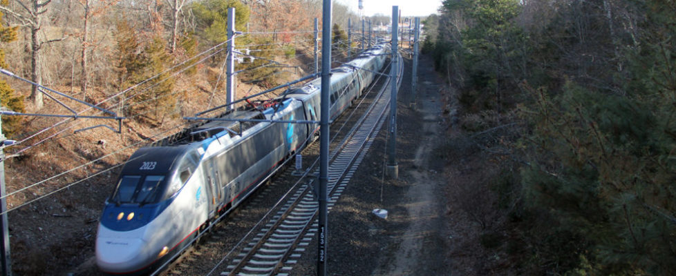
May 22, 2017 @ 9:23 am
Thank you Mr Payne for this wonderful and down to earth essay. I do not have words enough to credit you for what you mean to us for your efforts for helping all of us. Thank you.
May 18, 2017 @ 9:43 am
Lovely essay, thanks to Mr Payne and to CCA. Charlestown is a little natural gem along the coast among urban and suburban towns and long may it remain so.
May 15, 2017 @ 9:32 am
What a pleasure to read an essay on the historical geography of Southern Rhode Island. Initially the railroad tied the disparate mill and agricultural villages together, but later was a unifying force in the development of our present day communities. Thank you, Mr. Payne, for your research and insights.