Charlestown Critical Resources Impacted By Railroad Plan
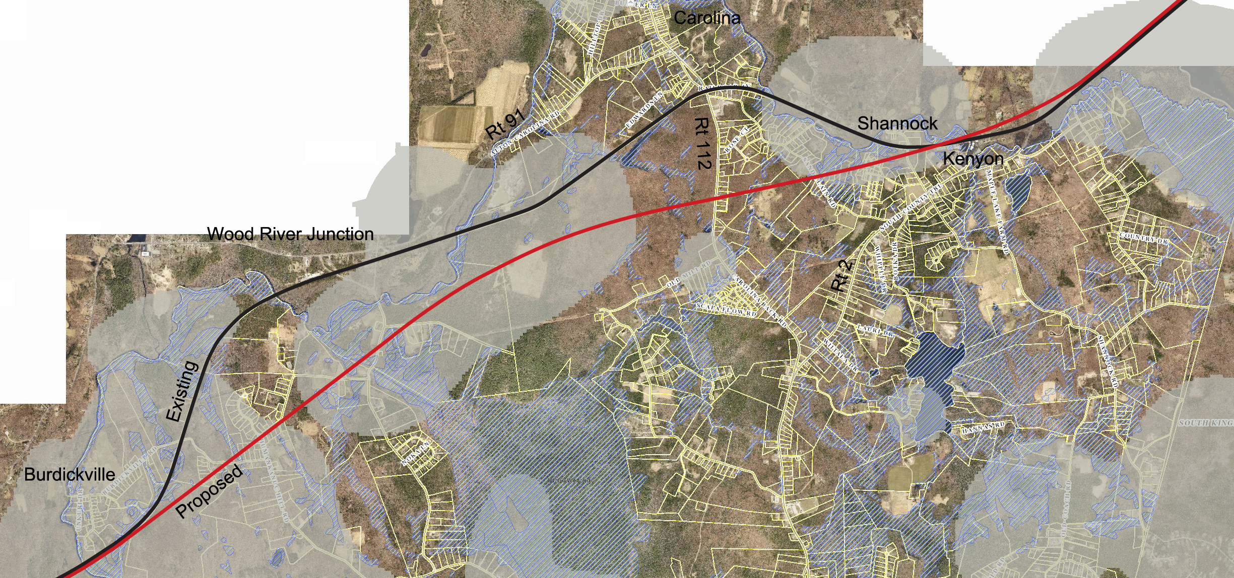
The above map shows the path of the proposed new rail lines through Charlestown Rhode Island in red. The existing rails are in black. The grey shaded areas are Rhode Island Natural Heritage Areas, blue cross hatched areas are wetlands. The underlying map is an ortho aerial photo with roads and lot lines from the Town of Charlestown GIS data. Click on the map for a more detailed view.
Natural Heritage areas are land areas where rare and endangered (“natural heritage”) species are found, or where the habitat type will support those species. The Rhode Island Natural History Survey has information on rare species in Rhode Island and the Natural Heritage designation at their website.
Visit Our Railroad Page For More On This Issue