Richmond Also Impacted By New Rail Lines
Maps, photos, and descriptive text by Cliff Vanover. Cliff creates and publishes maps and guides for hiking and mountain biking in recreational areas in and near Rhode Island, plus maps and guides of historic and architectural interest.
In this post, click any image for expanded view.
The discussion of the Federal Railroad Administration’s (FRA) plans for South County have dealt primarily with the impacts the proposed bypass route would have on Charlestown, and nearby Westerly. Richmond is where the bypass would begin. We’ll describe the proposed route and explore the impacts and changes envisioned by the FRA on this rural corner of Richmond.
What will Kenyon look like if this plan is built? It would probably be unrecognizable to anyone who lives here today.
Since word got out about the FRA’S far reaching plans for the Northeast Corridor on December 16th, politicians and appointed public officials have stated time and again that the FRA maps showing the proposed route is just a possible route, simply a line drawn on paper that could easily be moved or modified once phase two of the Environmental Impact Statement commences. They express a “Don’t worry, relax” attitude, which is hardly reassuring because an examination of the proposed bypass, especially in Richmond where it begins, clearly shows the route has been carefully sited to take into account the existing topography of the land, as well as the many buildings, other structures and roads in the way of the proposed bypass. It could shift a few feet in any direction, but moving this section is probably not an option. The designers and engineers have chosen the best possible route, for them, but not for those who live close by.
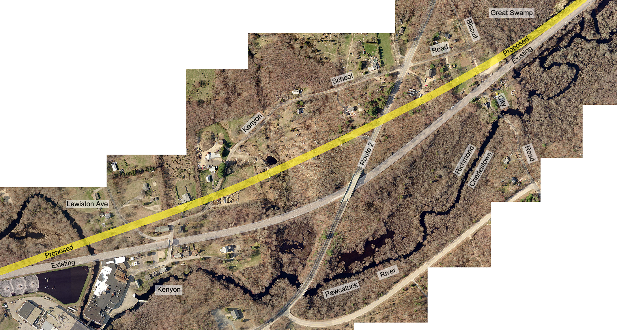
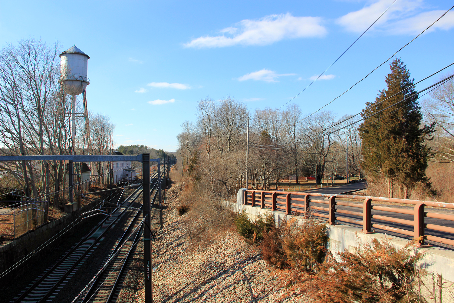
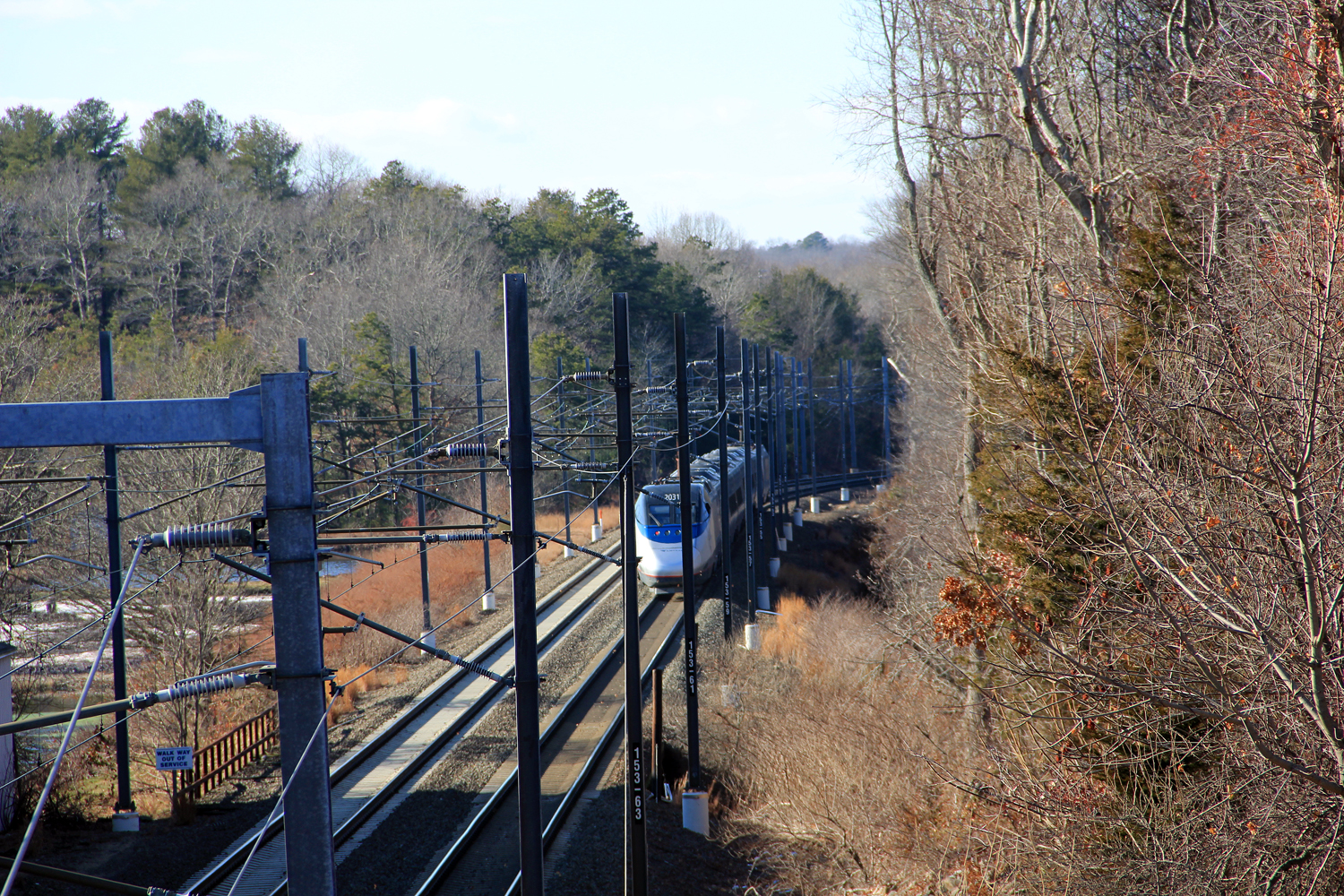
The aerial photo at the top of this post encompasses about a mile long section of existing track. Three additional aerial photos, each a zoomed in section of the aerial photo are below. Under the proposal, existing track remains for freight and slower moving trains. Click any photo to enlarge.
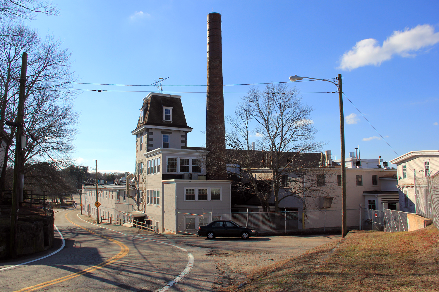
Near the western edge of this map is the historic mill village of Kenyon and Kenyon Historic District, which is eligible for listing in the National Register of Historic Places, but its boundaries have not yet been delineated. We’ll start on the east side of the aerial photo, where the proposed and existing tracks are envisioned to split apart.
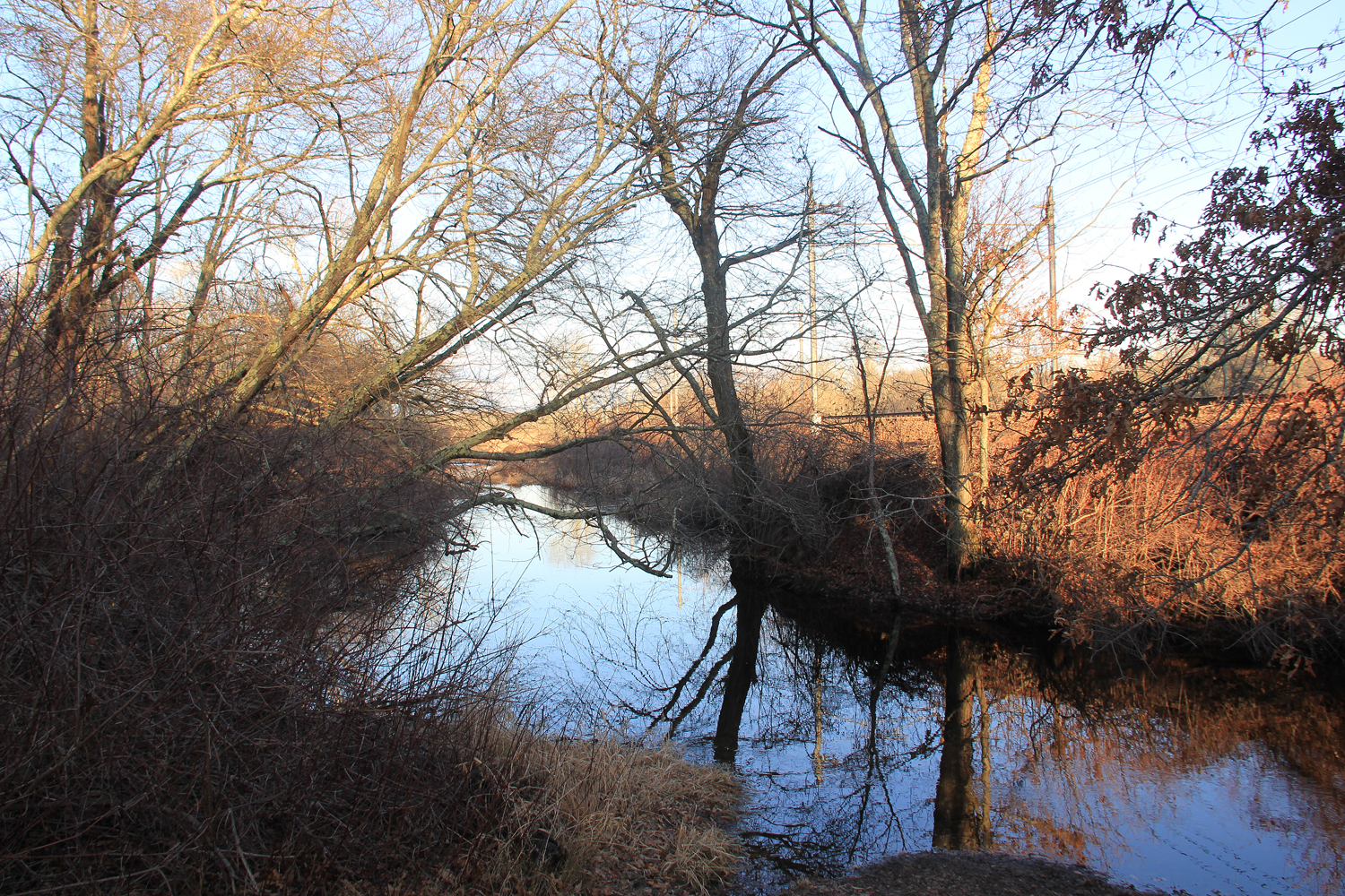
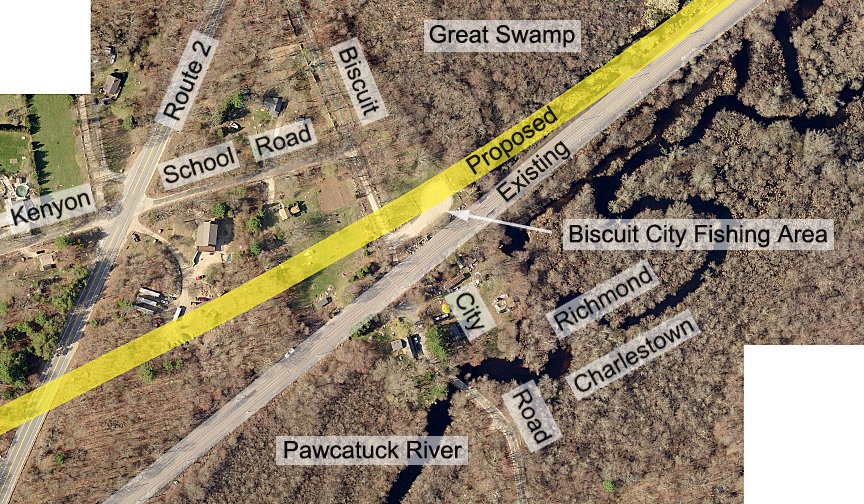
Coming from the northeast through the Great Swamp, the existing tracks would continue straight ahead towards the southwest, then to the west, while the proposed bypass would veer off, curving a little to the west and north. This split occurs in wetlands in RIDEM’s Great Swamp Management Area (photo 1).
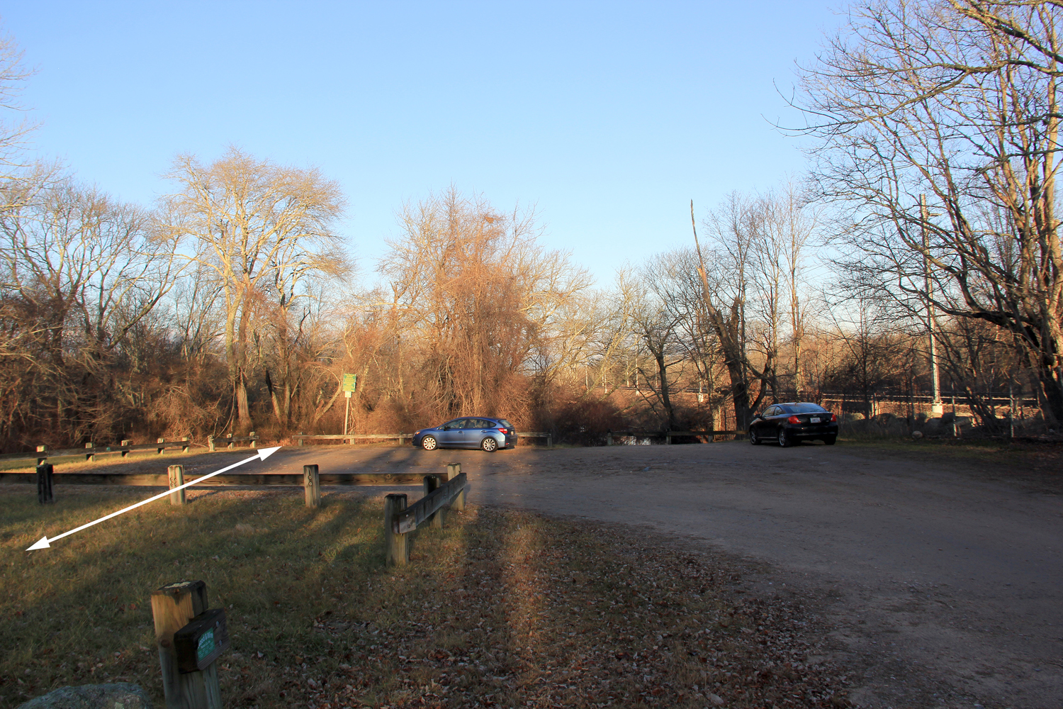
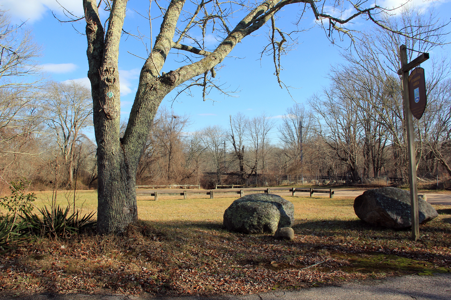
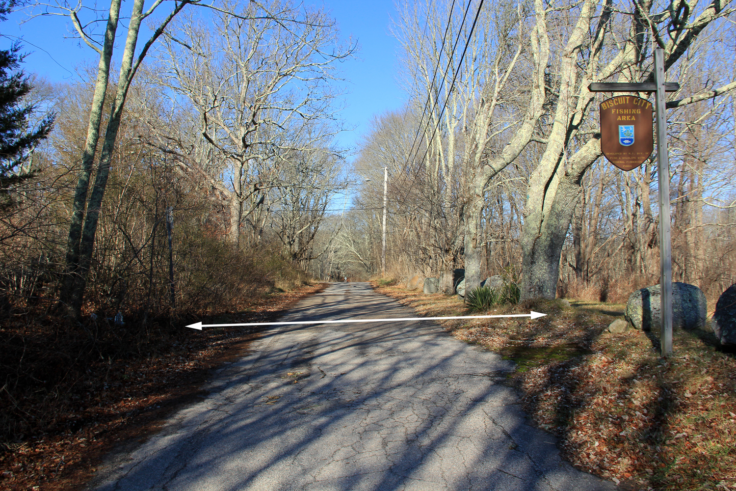
As soon as the proposed tracks leave the swamp and go onto firm ground, they would cross the parking lot of RIDEM’s Biscuit City Fishing Area (photos 2 & 3), obliterating both the lot and access to the Pawcatuck River.
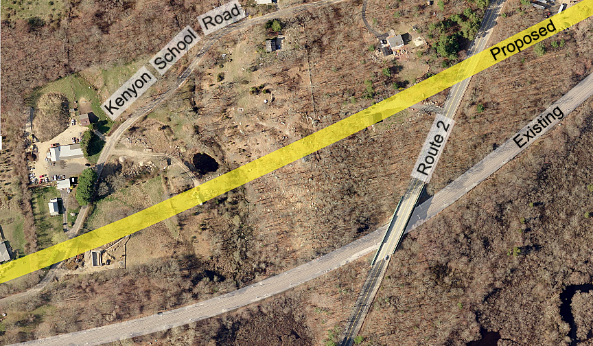
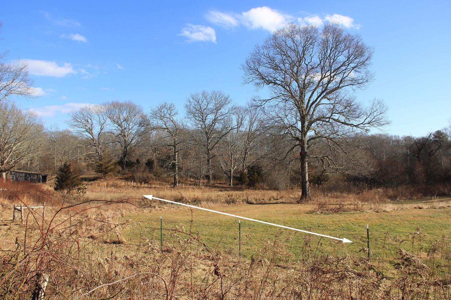
After crossing Biscuit City Rd. (photo 4), the tracks would pass through the yards of a few houses, then cross under Route 2, South County Trail. Condemnation of private and public property would have to take place here and along the entire proposed route for the federal government to accomplish their goal. At this point the proposed tracks would head up an incline reaching a high point about a third mile ahead on the north side of the village of Kenyon. Before it gets there the proposed tracks would cross a rocky farm field (photo 5). It’s roughly near this field that the proposed and existing tracks would start veering closer together.
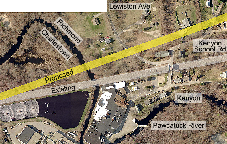
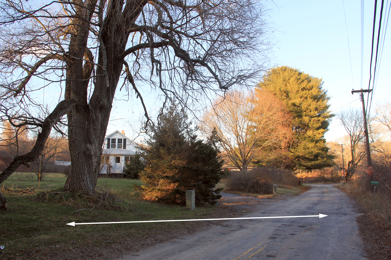
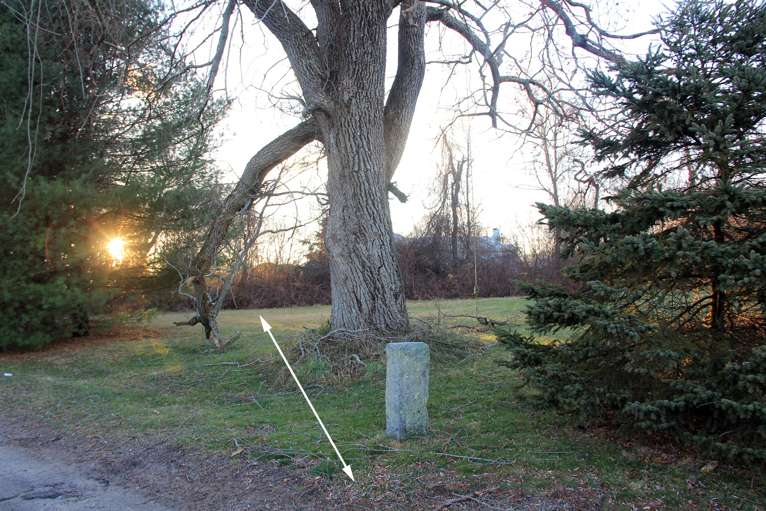
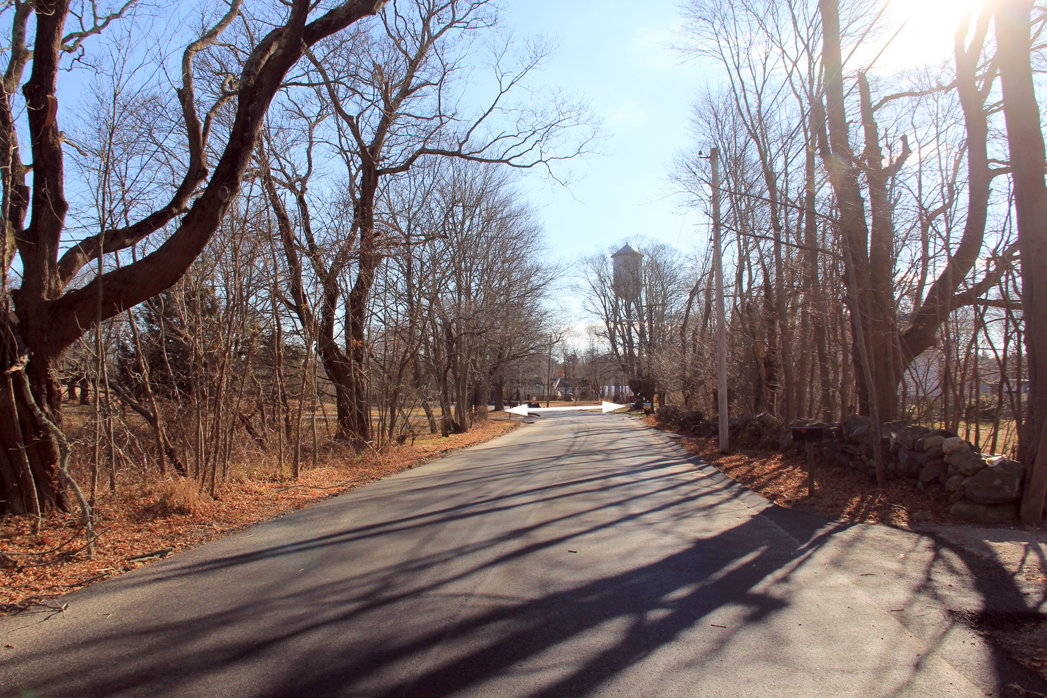
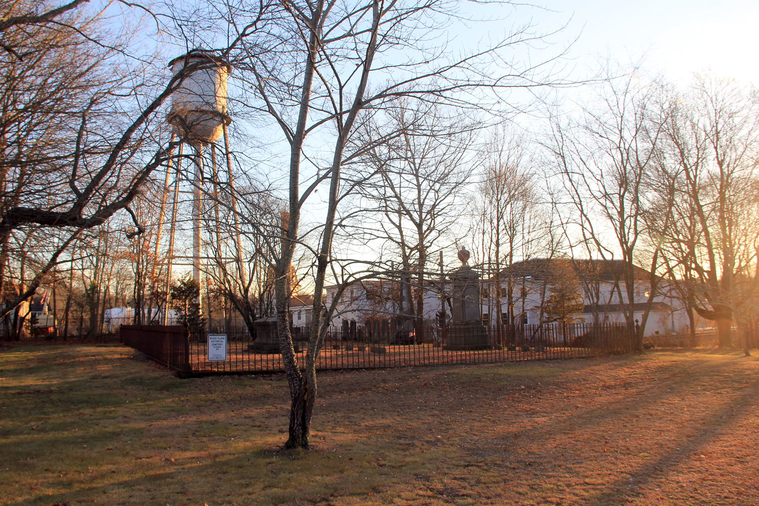
After crossing the field the proposed rails would cross Kenyon School Rd. (photos 6 & 7) through the front yard of an old farmhouse, and past more houses, possibly obliterating them, and through a small field (photo 8), then crossing tree lined Lewiston Ave. (photos 9 & 10) within sight of historic Kenyon Mill with its iconic industrial water tower, and by well kept houses and yards lining Lewiston Ave. and passing within feet of a historic cemetery that’s surrounded by an iron fence.
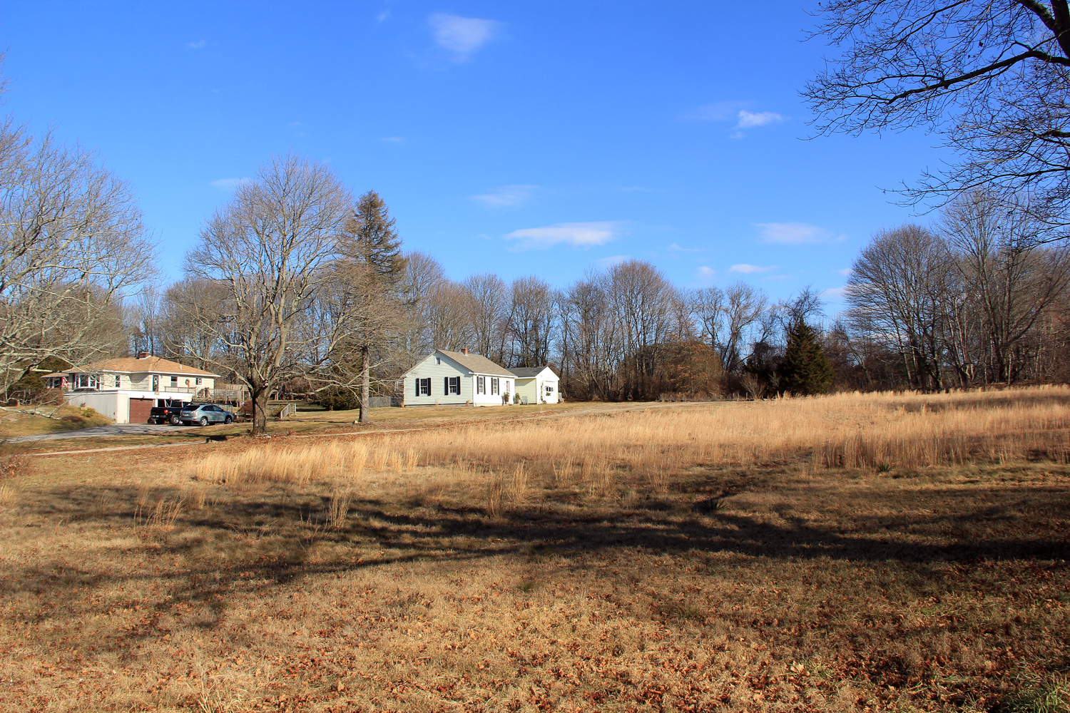
The proposed and existing tracks would continue inching towards each other as they go west, with the proposed tracks traversing ground about 20′ – 25′ higher than the existing tracks. Here, just past houses on the west side of Lewiston Ave., the land slopes down to a flood plain, wetlands and the Pawcatuck River. Here, a large bridge would have to be built to carry the tracks over this low area. Just ahead, roughly where Kenyon Mill’s waste water aeration ponds are located, the proposed tracks, still carried aloft by the nearly half mile long bridge would pass over the existing tracks, then cross the river into Charlestown. This new railroad bridge would be a massive, out of scale new structure. From here, the proposed tracks and bridge would continue straight ahead, towards Shannock Rd., which it would bisect about a hundred or so feet south of the Shannock Rd. bridge over the existing tracks, a change that would turn Shannock Road into a dead end in all likelihood. Continuing in a westerly direction, just ahead the new tracks (photos 11 & 12) would plow through Columbia Heights and the Columbia Heights Historic District.
January 9, 2017 @ 12:16 am
We will be at the school for the meeting. Someone dropped the communication ball here because there were meetings on this proposal in Providence last year and Mayor Alorza and the Mayor of Central Falls among others were there to praise this Amtrak idea. We certainly did not know about this until this Christmas. The Amtrak NEC people thought there was no opposition to this. Whether maliciously or not someone kept the Amtrak plan from the towns and people it will impact the most until the last minute, and shame on them. Let’s hope it’s not too late to stop this. The plans put the train right through our home and it impacts our son’s home.
January 4, 2017 @ 2:39 pm
This is making me so sick. I feel like I need the Barf Bag. We taxpayers are certainly being Railroaded. Everything in secrecy hoping right before Christmas the people involved wouldn’t see this stuff. Well surprise Surprise. Now for years DEM. Land trusts , wetlands. Historical lands. Environmental causes were funded by taxpayer in bonds all for preserving land. Pretty Tricky isn’t it. Farm land preservation and homes built in a pristine area. Now here comes the Federal government long with our Senators who think this is a great idea. Well think about it folks. Your take. Remember Jan 10 2017 at 7:00 pm public hearing AT CHARLESTOWN ELEMENTARY SCHOOL. We need support from all south county towns. See you there.
January 10, 2017 @ 12:08 am
We will be at the meeting. I agree with what you wrote. The secrecy and the hypocrisy of senators and congressmen.
You know if this proposal affected any of them, they would be screaming at the railway, ” how dare they come up with such a preposterous idea !”
Destroying all we care about and work to keep pristine, the historical, environmental, wetlands, and for me and so many like me – MY HOME / OUR HOMES !
I sent letters as soon as I heard about this, which was only this week…why??? because they wanted to keep us in the dark!
Hoping we fill the school to overflowing … we need everyone to step up and send the message…STOP THIS PLAN NOW !